

Photos: Gunn Oddny Olsen Haugen and Morten Olsen Haugen (CC BY-SA 4.0), Gunn Oddny Olsen Haugen and Morten Olsen Haugen (CC BY-SA 4.0), Gunn Oddny Olsen Haugen and Morten Olsen Haugen (CC BY-SA 4.0) · Wikimedia Commons
1 / 3Fulufjellet National Park
About
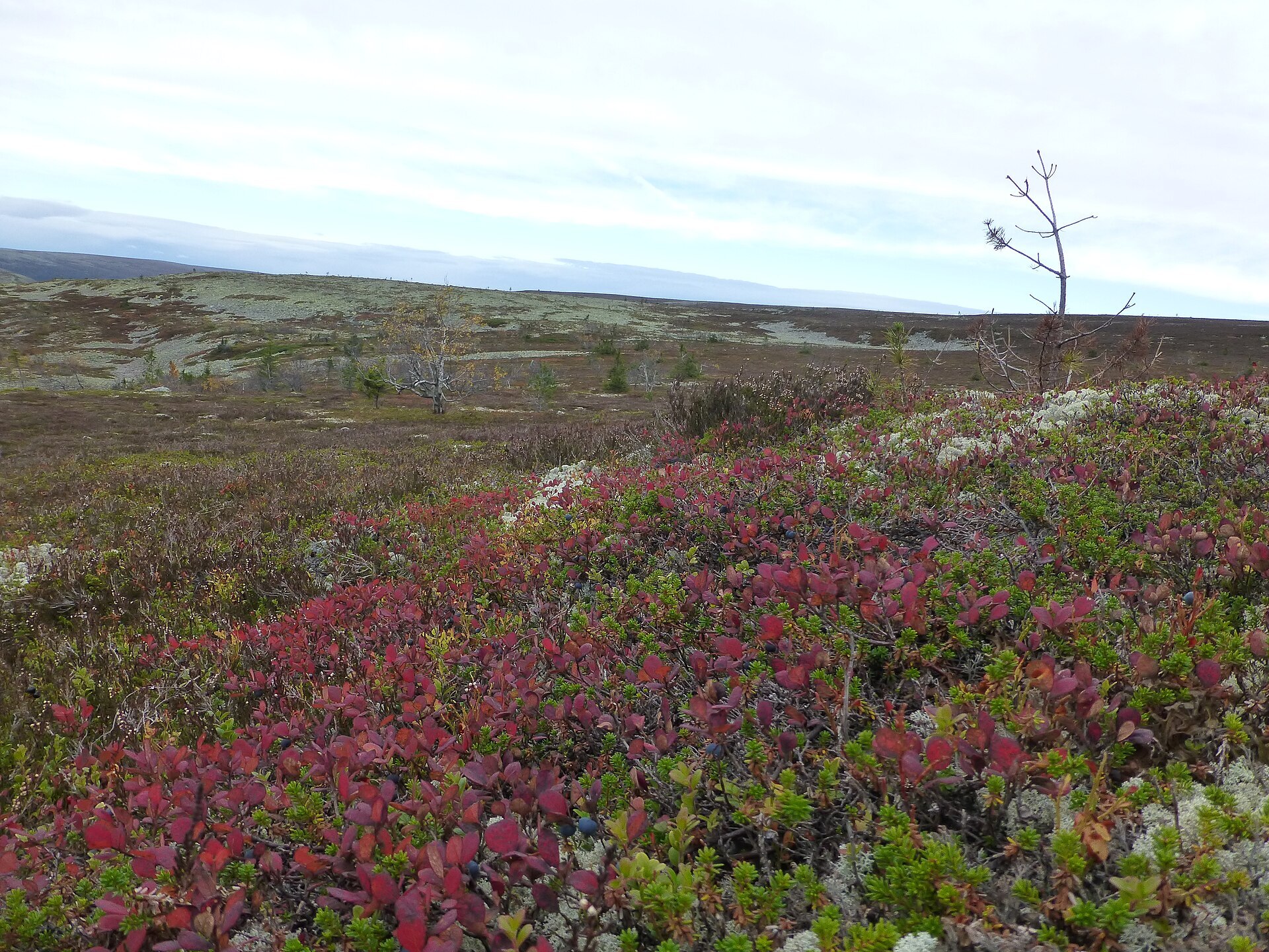
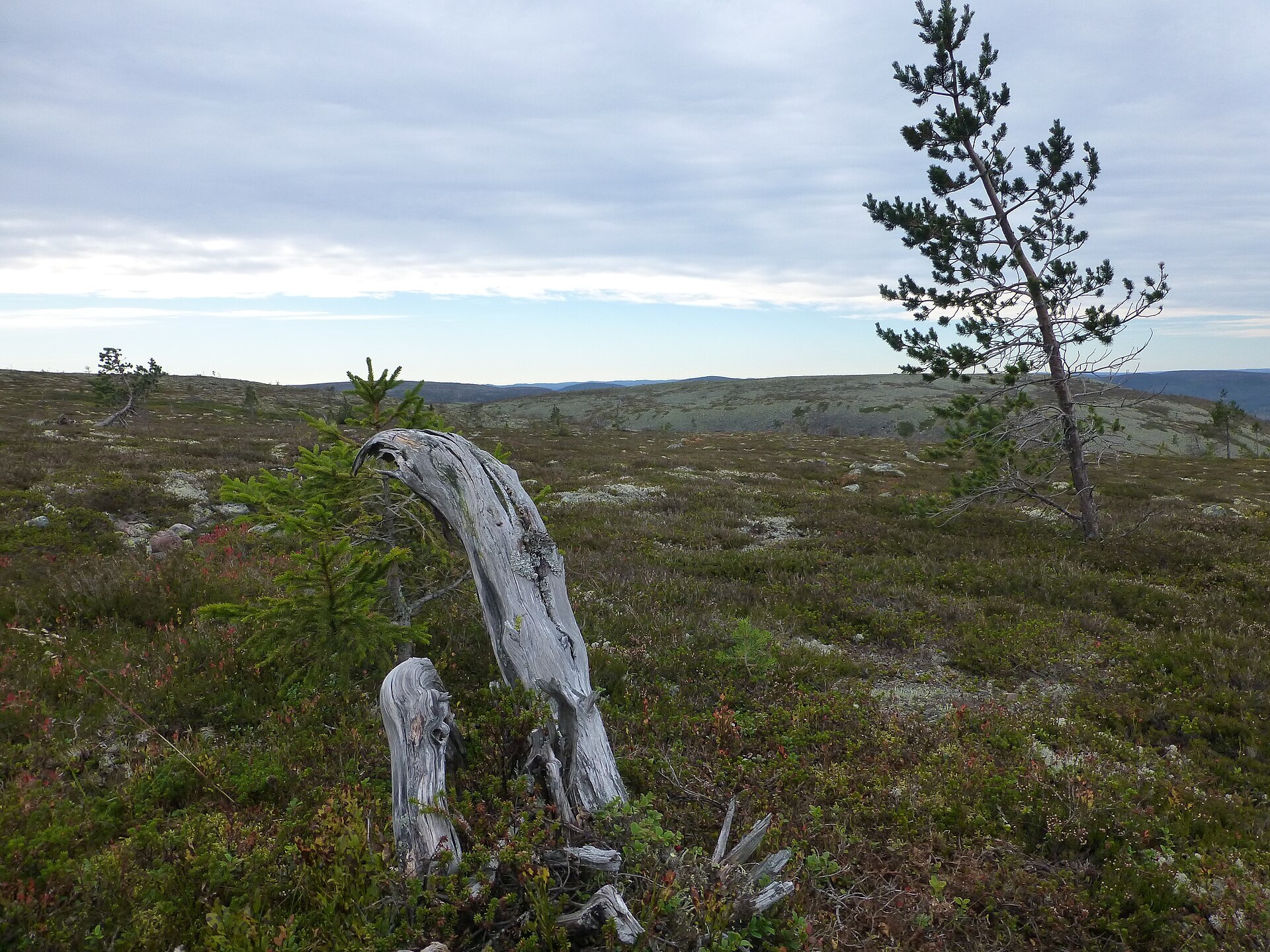
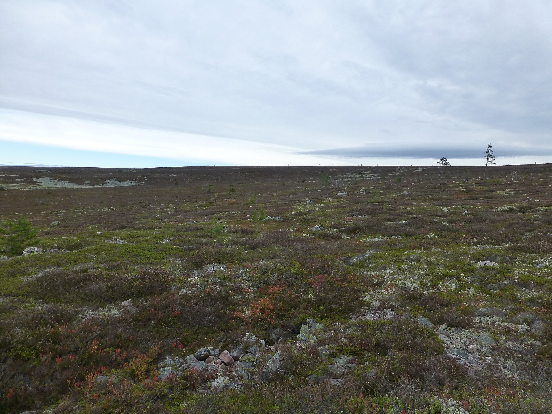
Where most mountains end in sharp peaks, Fulufjellet just goes flat. It is a broad plateau of reddish Trysil sandstone on the far eastern edge of Trysil, cut into three parts by the rivers Bergåa and Gira, and its highest point, Slottet, only reaches 1.047 m. The Norwegian park was protected in 2012 and covers 82,5 km². It joins the much bigger Fulufjället National Park in Sweden. No reindeer graze here, which is why the lichen lies thick and pale over the plateau. Down on the slopes grow old spruce and pine, some of the pines up to 400 years old. Bears den on both sides of the border, but they keep to the deep forest. The bird you will meet is the Siberian jay, the park's symbol, which often comes close.
Local knowledge: the border has never stopped people here. Several old roads between Norway and Sweden cross the park and are now walking paths. The oldest is Särnvegen, which runs north–south from Kjørdalengrende via Girdalssetra and Fulunebben and over to the Swedish side. It dates from before 1644, when Jämtland and Härjedalen still belonged to Norway, and was used by the people around for trade – some say pilgrims walked it too. Another path, Altarringvegen, climbs from Bergådalen over the border northeast of Slottet to Altarringen, a stone ring on the Swedish side. Nobody knows for sure what it was: an old offering place, say some, a falcon catchers' site, say others.
Visiting: take Rv 25 to Østby and Fv 564 to Ljørdalen (or Rv 25 to Støa and Fv 570), then Fulufjellvegen past Fulufjellet alpine centre to the Brynflået car park at Storbekkåsen. From here a marked trail climbs to the border cairns on Brynflået, with stone steps on the steepest part. In winter this is the only groomed ski track on the Norwegian side. At Bråtåfallet in Bergådalen there is a rest area by the falls. There are no huts on the Norwegian side. The shared visitor centre, Naturum Fulufjället, is in Sweden next to Njupeskär, one of Sweden's highest waterfalls. Keep dogs on a lead from 1 April to 20 August, and don't build new cairns. More on the park's official page.

Weather & Northern Lights
Now
In 24 hours
Northern Lights Chances
Weather forecast from MET Norway (yr.no). An indication, not a promise: aurora activity over this place (NOAA) times the clear sky in the best three-hour window of the night (MET Norway). The next nights rest on the Kp forecast only. More: our Northern Lights Forecast and the Northern Lights Map.
Getting there
Brynflået parkering, Ljørdalen, Trysil, Norway
Nearby
- Coop Marked LjørdalenNearest shop · 5,5 km
- LjørdalenNearest village5,5 km
- Vinmonopolet TrysilNearest Vinmonopolet · 29 km
- Stöten Camping GranfjällsbynNearest campsite15 km
Data from OpenStreetMap (ODbL)
On the way
Road reports within 40 km and the nearest road cameras, from Statens vegvesen (NLOD). The pictures refresh every few minutes; the reports are put into English word by word. All road cameras
Reviews
Rate this place
You are, or have been here? Give it your stars.
Comments
Thank you! Your comment is shown once we have read it.
No comments yet.
Write a comment
Let us know your experience with this place -- did something change? Your comment is shown once we have read it.
Please write a few words.
Thank you -- that is enough for now. Please try again in an hour.