

Jomfruland National Park
About
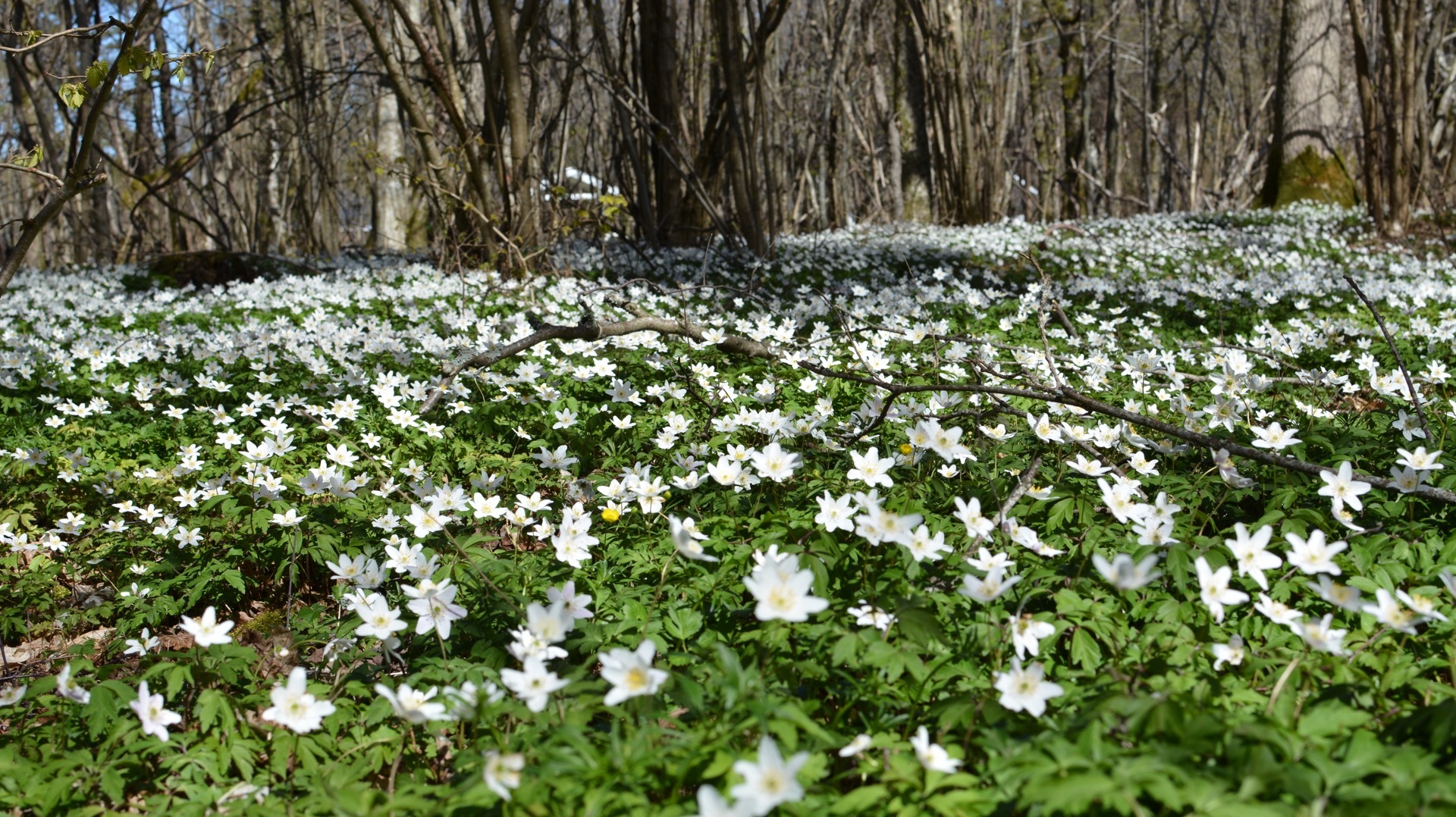
Jomfruland is a strip of land 7,5 km long and barely a kilometre wide, lying flat on the sea outside Kragerø. On the seaward side runs a pebble beach of almost seven kilometres, the longest open pebble beach on the Skagerrak, and behind it grow windswept oak and hazel. The national park was created in 2016 and covers 117 km², but 98 % of it is sea, and only about a fifth of Jomfruland itself is inside it, together with Stråholmen and around 160 islets. In late April and May the woods turn white with wood anemones, and more than 300 bird species have been recorded on the island.
Local knowledge: the whole island is a piece of the Ra, the moraine the ice sheet pushed up when its front stood still between 12.800 and 11.700 years ago. The ridge first lay deep under the sea. As the land slowly rose after the ice had gone, Jomfruland came up out of the water about 4.000 years ago. The waves washed the sand over to the sheltered inner side and left only round stones facing the open sea, and the parallel ridges of pebbles inland show where the beach was at different times. Among the stones you find rock from large parts of eastern Norway.
Local knowledge: in Old Norse the island was called Aurr, simply 'gravel'. Where Jomfruland, 'virgin land', comes from nobody knows for sure. One theory says it belonged to the Gimsøy nunnery in Skien. The old writer Peder Claussøn Friis tells that sailors would not say the island's real name while sailing past, and called it 'the good land' instead, a nod to the Virgin Mary in dangerous waters. In 2023 a local family found an oval brooch in their garden, probably from a woman's grave from the 800s, the first sure find from the Viking Age on the island.
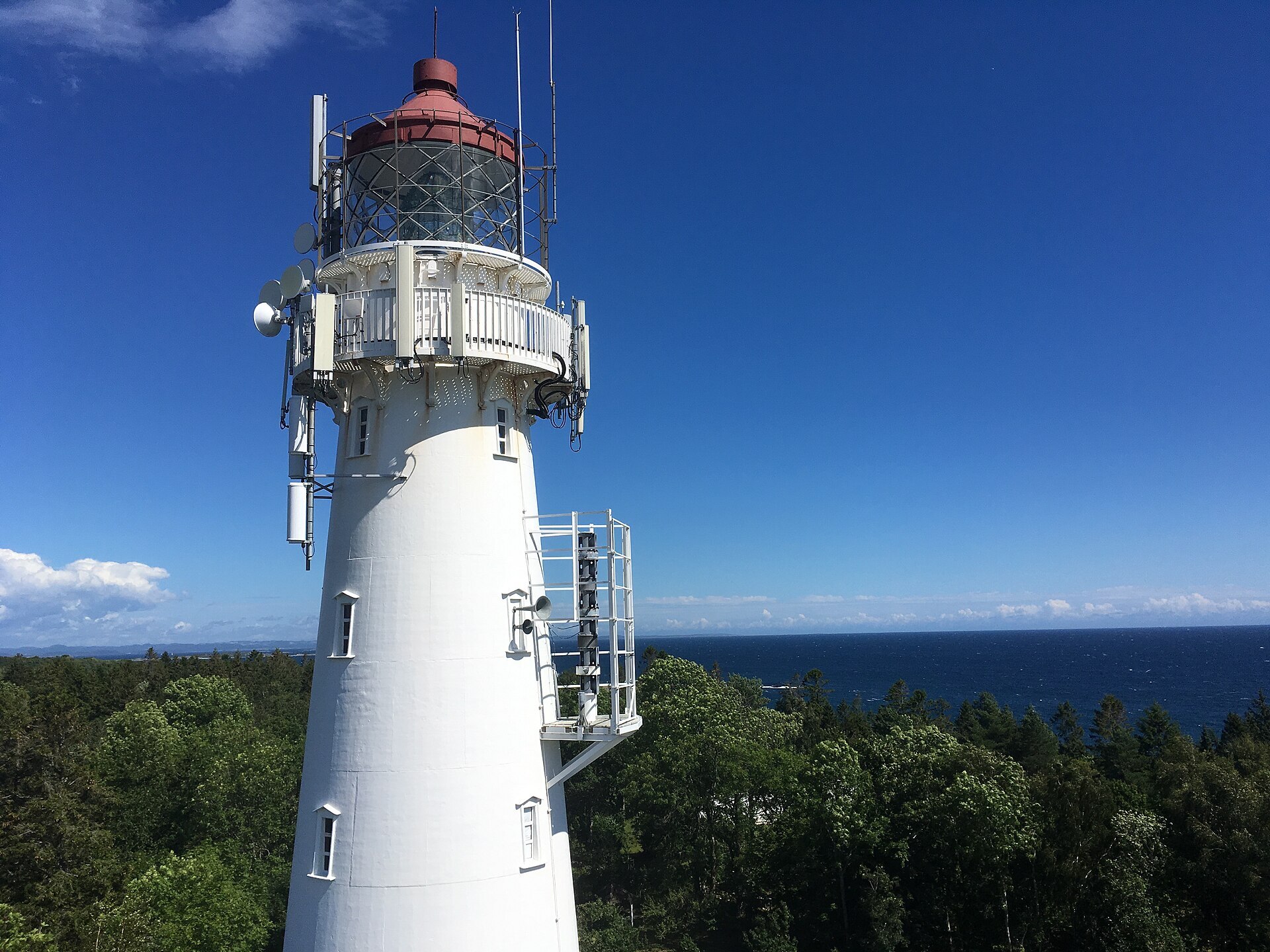
Visiting: leave the camper on the mainland. The pin is the ferry quay in Kragerø, and the crossing takes about an hour. Next to it, at Kragerø station, the park's visitor centre has a small branch. On the island you walk or cycle (bikes can be rented at Tårnbrygga). The visitor centre with the exhibition 'Dykk-Svøm-Pust' is in the old lighthouse keeper's house by the towers, and the brick tower from 1839 is open in summer. Just south of it lies Tårntjernet, the pond with white water lilies that is said to have inspired Theodor Kittelsen's painting 'Nøkken'. Dogs must be on a lead all year, and don't take any pebbles home or stack them into cairns. More: the park's official page and Jomfruland National Park's own site.

Weather & Northern Lights
Now
In 24 hours
Northern Lights Chances
Weather forecast from MET Norway (yr.no). An indication, not a promise: aurora activity over this place (NOAA) times the clear sky in the best three-hour window of the night (MET Norway). The next nights rest on the Kp forecast only. More: our Northern Lights Forecast and the Northern Lights Map.
Getting there
Kragerø ferry quay, Torvgata, 3770 Kragerø, Norway
Nearby
- Spar Kirkebukta KragerøNearest shop · 200 m
- St1 Kragerø KirkebuktaFuel200 m
- Toilets100 m
- KragerøNearest town200 m
- Vinmonopolet KragerøNearest Vinmonopolet · 100 m
- Kragerø Ferry QuayNearest ferryright here
- Kragerøfjorden CampingNearest campsite5,0 km
Data from OpenStreetMap (ODbL)
On the way
Road reports within 40 km and the nearest road cameras, from Statens vegvesen (NLOD). The pictures refresh every few minutes; the reports are put into English word by word. All road cameras
Reviews
Rate this place
You are, or have been here? Give it your stars.
Comments
Thank you! Your comment is shown once we have read it.
No comments yet.
Write a comment
Let us know your experience with this place -- did something change? Your comment is shown once we have read it.
Please write a few words.
Thank you -- that is enough for now. Please try again in an hour.