

Photos: Tore Veisetaune, Statskog Fjelltjenesten (CC BY-SA 2.0), Ivana Richterova (CC BY-SA 3.0) · Wikimedia Commons
1 / 2Láhko National Park
About
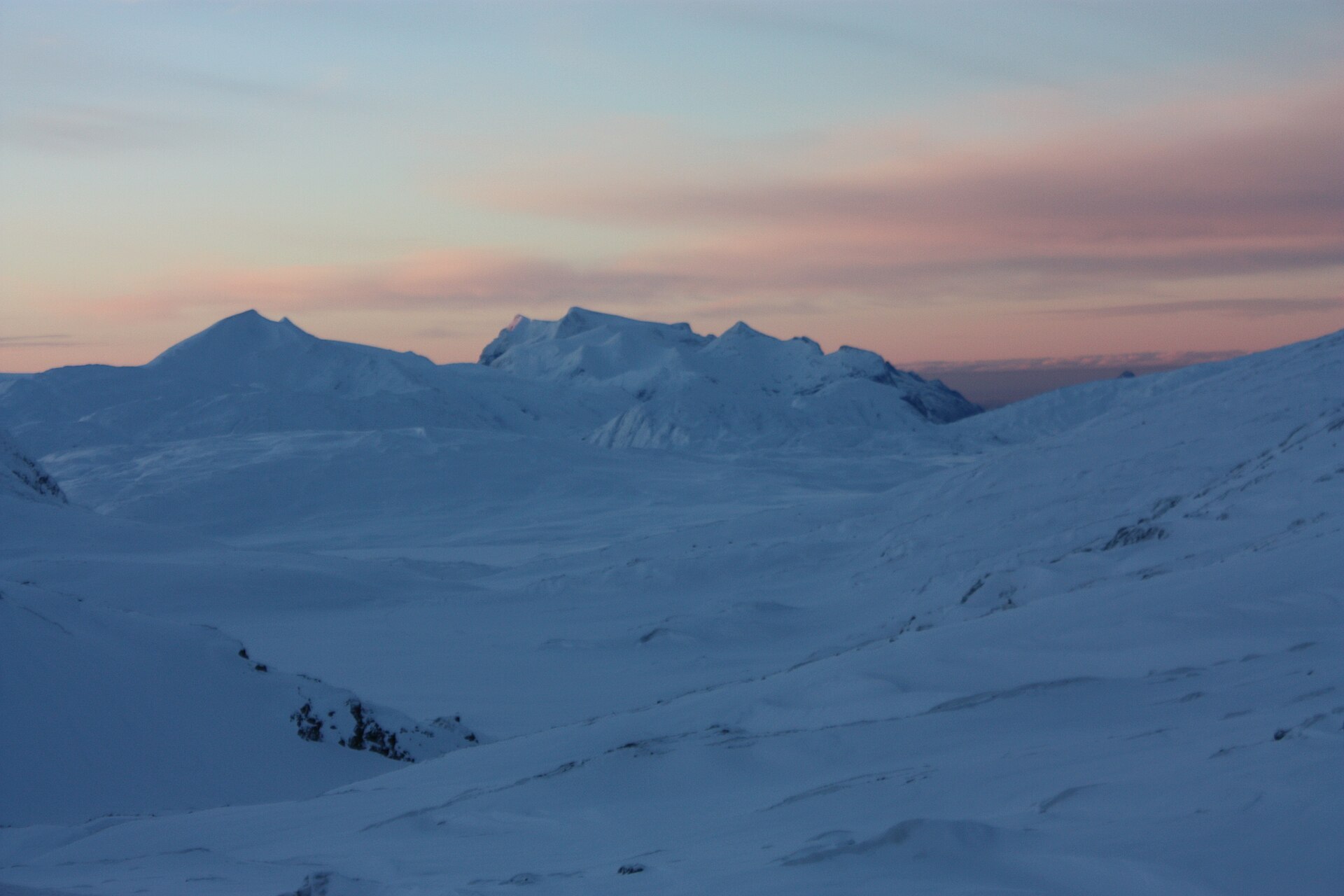
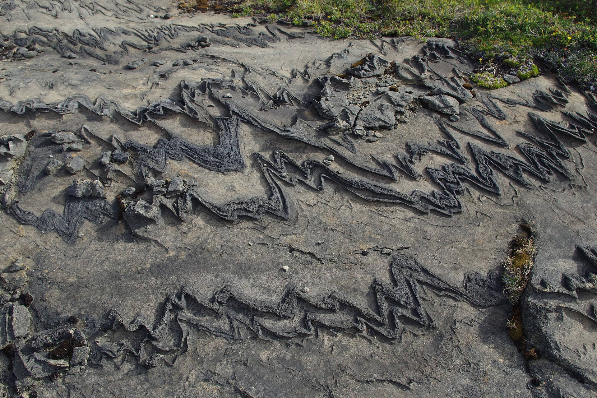
Up on Glomfjellet, east of Glomfjord, the ground looks like no other mountain in Norway. Láhko is the country's largest continuous area of alpine karst: soft limestone and marble that rain and meltwater have been dissolving since the ice left. Streams sink into cracks and run on underground, there are natural stone bridges and caves, and some big boulders sit on small pedestals as if they were floating. Look closely and you'll find shapes locals call stone hearts and snakes. The name is Lule Sámi for a high, wide plateau, and that fits. Most of the park lies above the tree line, between Meløy, Gildeskål and Beiarn, and the highest point is Nordre Glomvassfjellet, 1.305 m, where Láhko meets Saltfjellet-Svartisen National Park. The 188 km² park was created in December 2012. The lime also feeds more than 200 plant species, and reindeer graze here in summer.
Local knowledge: in the 1950s the French geomorphologist Jean Corbel wrote about these heights as a closed, hostile world, always in fog or snowstorms, full of bleached bones and with “three thousand gaping chasms”. He called the plateau Navnløsfjell, “the mountain that lost its name”. His words were enough to send a Cambridge caving expedition north in 1961. When they got here, the power station in Glomfjord lent them a boat and a hut with electric heating, and most of Corbel's deep shafts turned out to be shallow cracks. They still explored three caves of about 400 metres each, in water barely above freezing. The local hunting and fishing club from Glomfjord has been coming up here since 1930.
Visiting: on Fv17 (Kystriksvegen), turn off between the Svartisen and Fykan tunnels and follow the construction road from Fykan up the mountain. The pin is the car park by Namnlausvatnet, where most trails start. From here a marked trail runs about 4,6 km one way to Corbel's Canyon and the Corbel bridge, the best-known sights: first along the path for about 1,1 km, then north through Fiskvasskaret and along the north side of Svalvatnet. Stay on the marked trails, as boots quickly wear down the fragile formations, and leave the caves to equipped cavers. More on the park's official page. Nearby in our guide: Svartisen Glacier – Engabreen and Austerdalsisen.

Weather & Northern Lights
Now
In 24 hours
Northern Lights Chances
Weather forecast from MET Norway (yr.no). An indication, not a promise: aurora activity over this place (NOAA) times the clear sky in the best three-hour window of the night (MET Norway). The next nights rest on the Kp forecast only. More: our Northern Lights Forecast and the Northern Lights Map.
Getting there
Namnlausvatnet, Glomfjellet, Meløy, Norway
Nearby
- Extra GlomfjordNearest shop · 9,8 km
- GlomfjordNearest town9,7 km
- Vinmonopolet ØrnesNearest Vinmonopolet · 22 km
- Ørnes Ferry QuayNearest ferry22 km
- Skaugvoll campingNearest campsite24 km
Data from OpenStreetMap (ODbL)
On the way
Road reports within 40 km and the nearest road cameras, from Statens vegvesen (NLOD). The pictures refresh every few minutes; the reports are put into English word by word. All road cameras
Reviews
Rate this place
You are, or have been here? Give it your stars.
Comments
Thank you! Your comment is shown once we have read it.
No comments yet.
Write a comment
Let us know your experience with this place -- did something change? Your comment is shown once we have read it.
Please write a few words.
Thank you -- that is enough for now. Please try again in an hour.