

Photos: Frankemann (CC BY-SA 4.0), Frankemann (CC BY-SA 4.0), Frankemann (CC BY-SA 4.0) · Wikimedia Commons
1 / 3Rago National Park
About
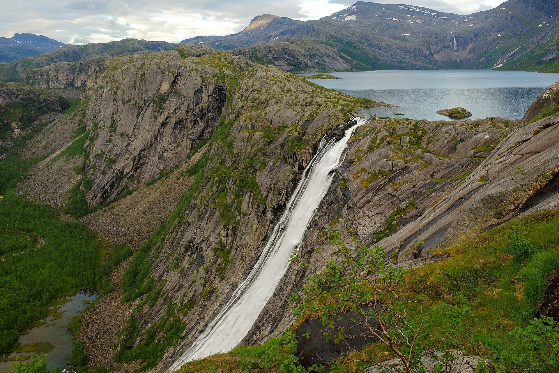
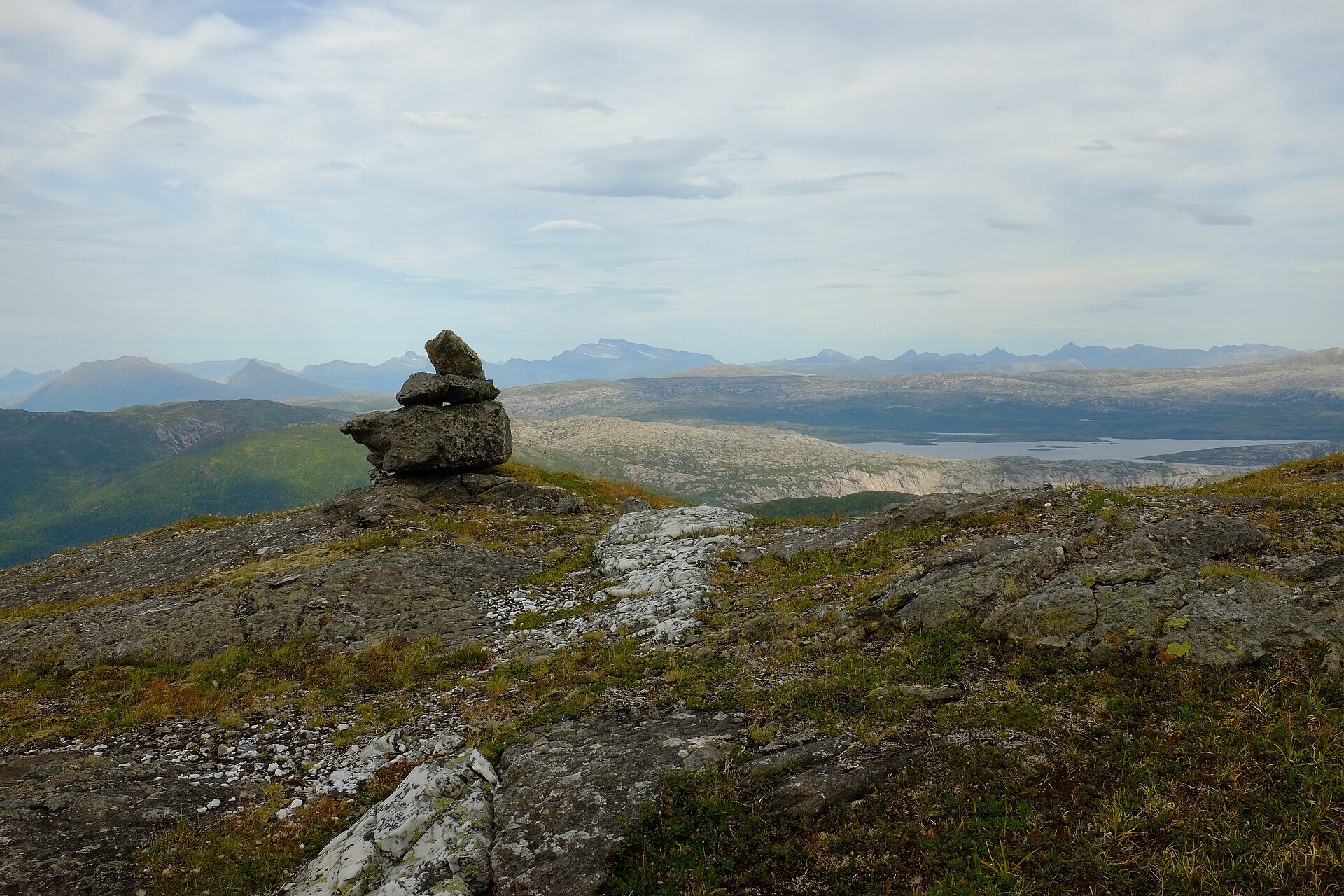
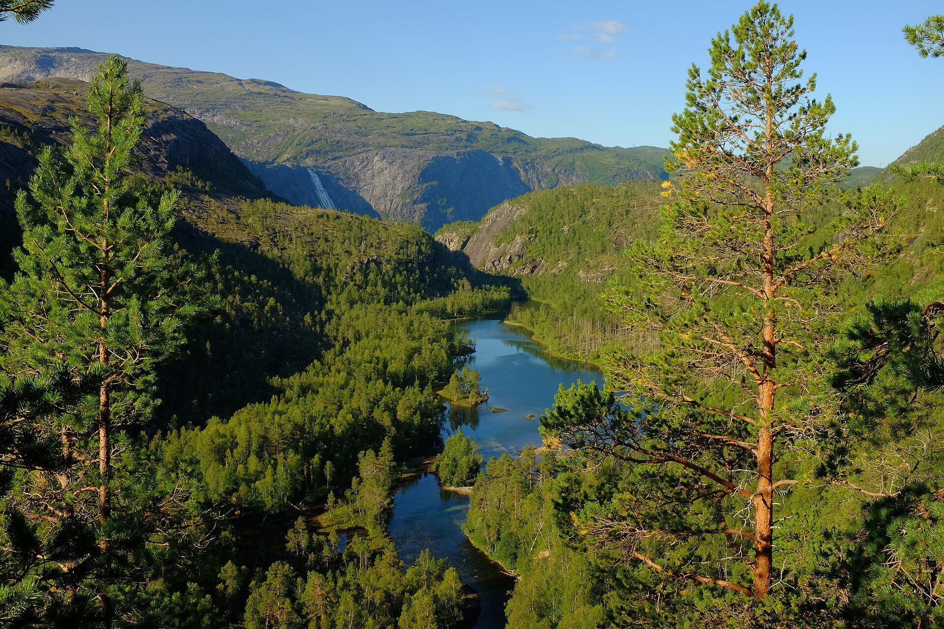
Rago is only 171 km², but at the Swedish border it joins Padjelanta, which runs on into Sarek and Stora Sjöfallet. Together they make about 5.700 km² of protected mountains, one of the largest wild areas in Europe. On the Norwegian side it is a rough land of bare granite, smooth slabs scraped by the ice, boulders everywhere and deep clefts. Litlverivassforsen drops 223 m from Litlverivatnet down into Storskogdalen, and the valley floor has old pine forest with so much dead wood that 20 red-listed fungi have been found near Storskogvatnet. The highest point is Austre Gaulis at 1.327 m, and the mountain Rago itself is 1.312 m. The park was protected in 1971. Unlike the Swedish side, Rago has a coastal climate, with a lot of rain and fog that often sits on the tops.
Local knowledge: on 11 June 1732 the Swedish botanist Carl Linnaeus came down an old cairn route over Lappfjellet to Megården in Tørrfjorden, in the middle of his journey through Lapland. He had two Sámi companions in Rago. The same route was used by Swedish Sámi who came down to trade reindeer meat, cheese and furs for salt, fish oil and gunpowder at the market in Tørrfjorden, a trade that went on until 1850. Boats built in Sørfold were carried up this way to the big lakes in Sweden, and during the Second World War refugees used it to reach neutral Sweden. Look closely on the rock and you may see tiny rings of stones: Sámi children built them as play reindeer fences. In 1917 and 1918 men mined lead and silver near the Rago summit and carried the ore out on their backs.
Visiting: turn off the E6 in Sørfold to Lakshol, about 6 km from the main road, where the pin and a car park are. Park only at the marked car parks, Lakshol or Litjsand, never along the road. A marked path with plank walks over the bogs leads about 7 km to Storskogvatnet, where Statskog has an open hut. From there the Ragorunden loop goes past Litlverivassforsen and down to Litjsand, just over 20 km in all, with three suspension bridges. It looks short on the map, but the terrain is steep, rocky and wet, and small streams turn into big rivers fast after rain. The huts are small, so bring a tent. Don't burn dead pine, only fallen twigs. More on the park's official page and the park's own site ragonasjonalpark.no.

Weather & Northern Lights
Now
In 24 hours
Northern Lights Chances
Weather forecast from MET Norway (yr.no). An indication, not a promise: aurora activity over this place (NOAA) times the clear sky in the best three-hour window of the night (MET Norway). The next nights rest on the Kp forecast only. More: our Northern Lights Forecast and the Northern Lights Map.
Getting there
Lakshol, Sørfold, Norway
Nearby
- Coop Prix StraumenNearest shop · 14 km
- Toilets400 m
- RøsvikaNearest village13 km
- Vinmonopolet FauskeNearest Vinmonopolet · 27 km
- Festvåg Ferry QuayNearest ferry43 km
- Øyra CampingNearest campsite3,9 km
Data from OpenStreetMap (ODbL)
On the way
Road reports within 40 km and the nearest road cameras, from Statens vegvesen (NLOD). The pictures refresh every few minutes; the reports are put into English word by word. All road cameras
Reviews
Rate this place
You are, or have been here? Give it your stars.
Comments
Thank you! Your comment is shown once we have read it.
No comments yet.
Write a comment
Let us know your experience with this place -- did something change? Your comment is shown once we have read it.
Please write a few words.
Thank you -- that is enough for now. Please try again in an hour.