

Photos: Karl Ragnar Gjertsen (CC BY-SA 4.0), Andreas Eriksson (Public domain) · Wikimedia Commons
Photos: The National Library of Norway · Unsplash
1 / 3Namsos
About
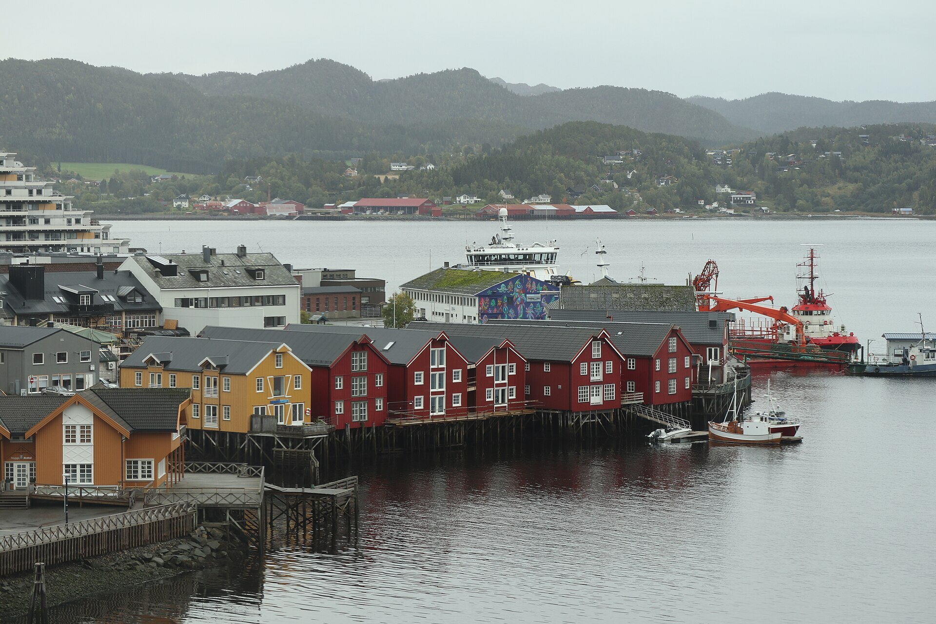
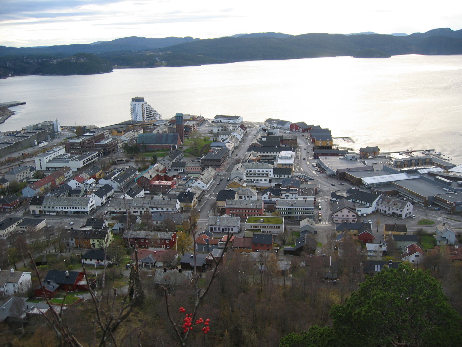
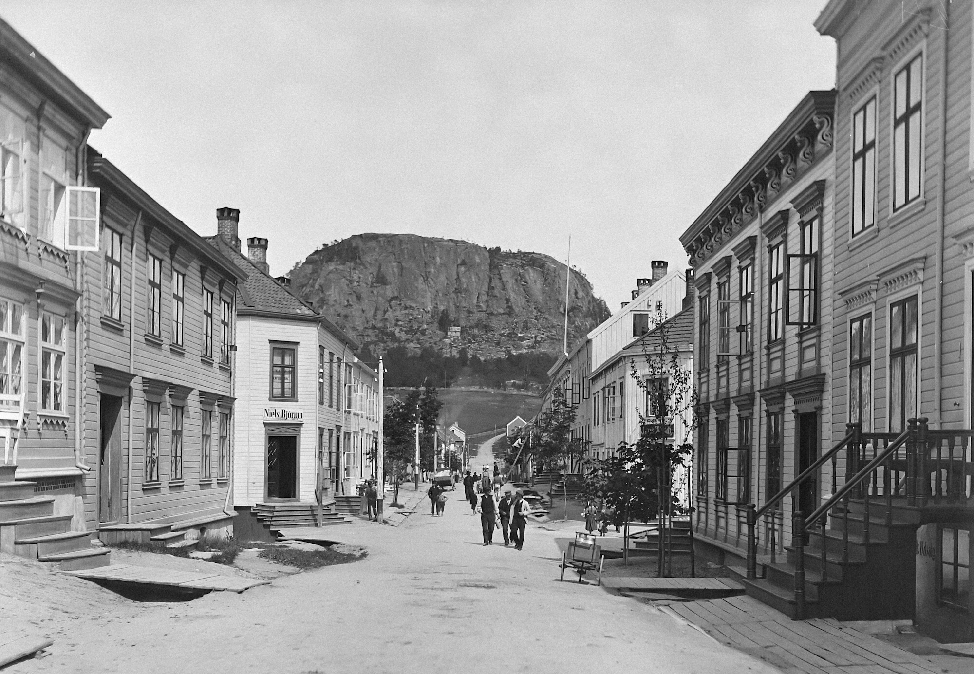
Namsos lies where the Namsen, one of Norway's big salmon rivers, runs out into the Namsenfjord. The centre is on the north bank, around the harbour: wide, straight streets and low post-war blocks, with Klompen, a 114-metre knoll that serves as the town's own little mountain, rising above the houses.
It's the town for the whole of Namdalen: the hospital serves the region and is the biggest employer, and shops and car dealers draw people in from the valley. Namsos began as a port for shipping timber and grew on the sawmills. The name says where it is. Os is a river mouth, so Namsos is simply the mouth of the Namsen, whose old name, Nauma, is of unknown origin. The municipality also has an official South Sámi name, Nåavmesjenjaelmie.
Local knowledge: Namsos became a ladested in 1845 with 591 people. Fires took the wooden town in 1872 and again in 1897, but what shaped today's centre happened in April 1940. After the German invasion, British troops came ashore here from 14 April and French mountain troops on 19 April, meant to march south and retake Trondheim. The Germans answered from the air. On 20 April bombers attacked all day, and most of the town burned: the houses, the railway station, a church and the wooden wharves. About 3.600 people lived here then. The Allies were taken off by ship in the first days of May, with the quays ablaze behind them. Only a handful of buildings survived, among them the old Fogdegården. The new centre was laid out with room to breathe, and all of it is now on Riksantikvaren's list of post-war town planning worth keeping.
Born here: Åge Aleksandersen (born 1949), a sawmill worker's son, started playing rock in Namsos in the mid-1960s and became one of the pioneers of trønderrock. In 1975 he sang that it's a long way from Namsos to the Royal Albert Hall. In 2016 he played there, to some 4.000 people from Trøndelag.
Visiting: the pin points to the culture house in Stasjonsgata, which also serves as the tourist information. Kunstmuseet Nord-Trøndelag, the art museum of the old county, is in the same building, our rainy-day tip. Rock City, the national rock centre opened in 2011, wound up most of its work in 2016, but it still has its trønderrock exhibition, with Åge Aleksandersen's writing room. Ask at the tourist information about seeing it. Across the river at Spillum, the Norwegian Sawmill Museum runs Spillum Dampsag, a steam sawmill from 1884, the way it worked half a century ago. For the view, walk up Klompen. Heading up Namdalen, Bjøra Camping is at Skogmo in Overhalla.
Fact sheet
- People: 8.494 in Namsos, 15.112 in Namsos municipality
- County: Trøndelag
- Town since: 1845 (as a loading place)
- Typical industries: car sales and repair, the hospital (Sykehuset Namsos), farming
Population on 1 January 2026, from Statistics Norway. Typical industries are the ones with a much bigger share of the jobs here than in Norway as a whole (Statistics Norway, 2025).
Weather & Northern Lights
Now
In 24 hours
Northern Lights Chances
Weather forecast from MET Norway (yr.no). An indication, not a promise: aurora activity over this place (NOAA) times the clear sky in the best three-hour window of the night (MET Norway). The next nights rest on the Kp forecast only. More: our Northern Lights Forecast and the Northern Lights Map.
Getting there
Stasjonsgata 3, 7800 Namsos, Norway
Nearby
- Rema 1000 NamsosNearest shop · 100 m
- St1 NamsosFuel100 m
- Toilets1,9 km
- NamsosNearest town400 m
- Vinmonopolet NamsosNearest Vinmonopolet · 500 m
- Ølhammeren Ferry QuayNearest ferry20 km
- Namsos campingNearest campsite3,9 km
Data from OpenStreetMap (ODbL)
On the way
Road reports within 40 km and the nearest road cameras, from Statens vegvesen (NLOD). The pictures refresh every few minutes; the reports are put into English word by word. All road cameras
Reviews
Rate this place
You are, or have been here? Give it your stars.
Comments
Thank you! Your comment is shown once we have read it.
No comments yet.
Write a comment
Let us know your experience with this place -- did something change? Your comment is shown once we have read it.
Please write a few words.
Thank you -- that is enough for now. Please try again in an hour.