

Landmarks in Norway by camper
The fjords, scenic routes, waterfalls, viewpoints and sights we think are worth the drive -- each with photos, how to get there and what campers should know about parking, overnight stays and the season.
81 landmarks
Fjord Norway and Southern Norway 26
-
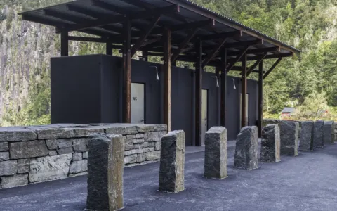 Special ToiletAllmannajuvet zinc mines – SaudaOld zinc mines in Sauda turned museum, with a gallery, café and toilet building by Peter Zumthor and guided mine tours in summer.
-
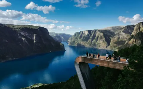 Scenic RouteAurlandsfjellet Scenic RouteStart of the route in Aurlandsvangen: the 47 km “Snow Road” past Stegastein and over the mountain to Lærdal.
-
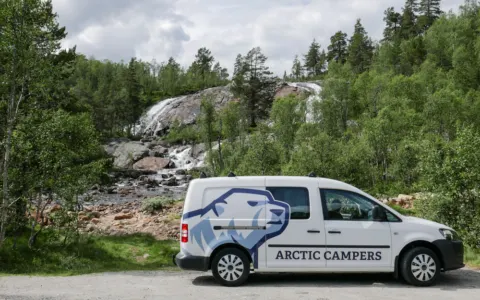 WaterfallEdlandsfossen - Aust-AgderCamp spot right by a waterfall beside the road.
-
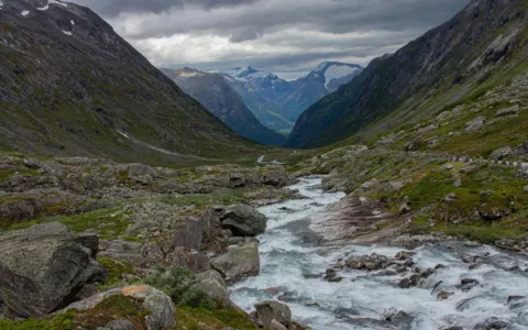 Scenic RouteGamle Strynefjellsvegen Scenic RouteStart of the route at Videsæter: 27 km of hand-built gravel road with stone walls over the mountain to Grotli.
-
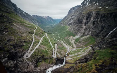 Scenic RouteGeiranger–Trollstigen Scenic Route104 km past Geiranger and Trollstigen’s eleven hairpins to Romsdalen. Closed in winter and can close at short notice: check the road stat…
-
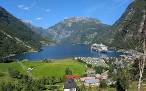 FjordGeirangerfjordUNESCO World Heritage fjord: 20 km of sheer walls and waterfalls, with the village of Geiranger at its head.
-
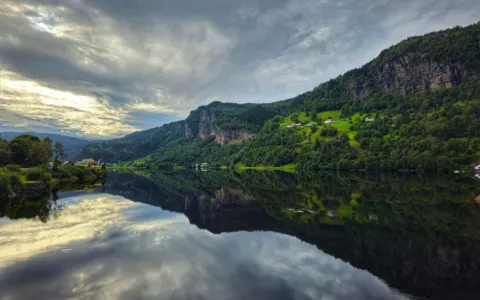 FjordHardangerfjordThe fjord of fruit orchards: about 179 km long, with blossom in May, big waterfalls and the way to Trolltunga.
-
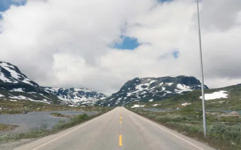 Scenic RouteHardangervidda Scenic RouteStart of the route in Eidfjord: 67 km up Måbødalen past Vøringsfossen and across Norway’s largest mountain plateau to Haugastøl.
-
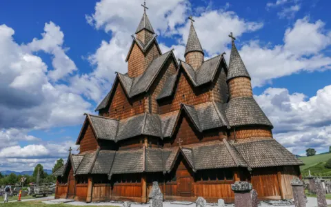 Landmark / POIHeddal Stave ChurchVisit the biggest stave church of Norway. Built in 1200 A.D.
-
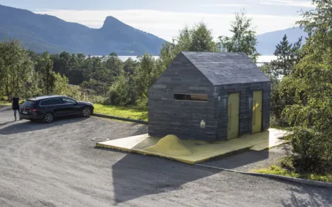 Landmark / POIHereiane – HardangerRest stop by the Hardangerfjord with a striking service building of slate, concrete and glass in strong colours.
-
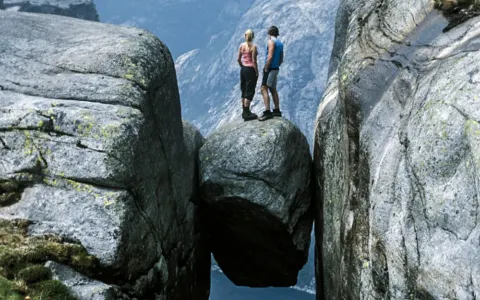 Landmark / POIKjerag - LysefjordDemanding hike to Kjeragbolten, the giant boulder wedged in a crevice above the Lysefjord.
-
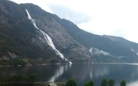 WaterfallLangfossen – Åkrafjorden612 metres from the mountain top straight into Åkrafjorden – right beside the E134.
-
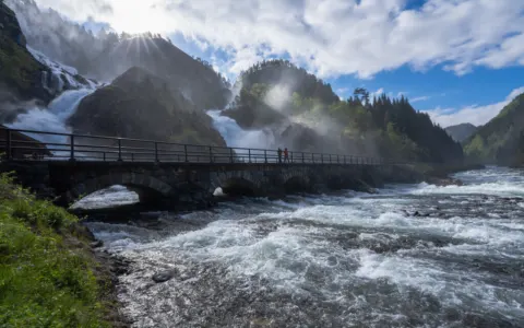 WaterfallLåtefossen – HardangerA twin waterfall that thunders down right beside Rv13 and under an old stone bridge.
-
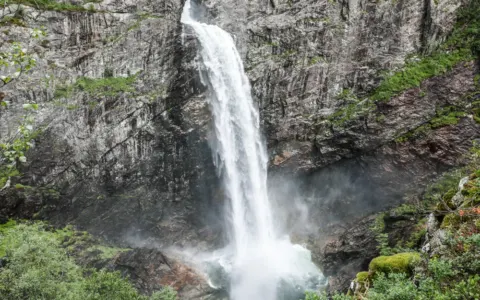 WaterfallMånafossen - WaterfallImpressive 92-metre-tall waterfall. Hike takes 30 min. one way.
-
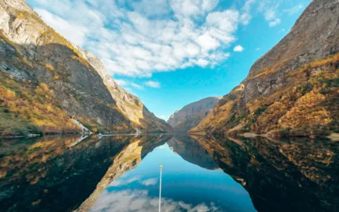 FjordNærøyfjordUNESCO World Heritage fjord, only about 250 metres wide in places – best seen by boat from Gudvangen or Flåm.
-
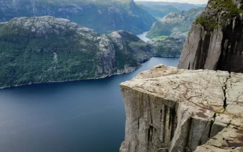 Scenic RouteRyfylke Scenic RouteStart of the route at Oanes on the Lysefjord: 260 km of fjords, waterfalls and the Saudafjellet pass to Røldal.
-
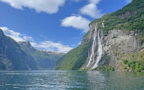 WaterfallSeven Sisters – GeirangerfjordSeven streams side by side down a 410-metre cliff – seen best from the ferry on the Geirangerfjord.
-
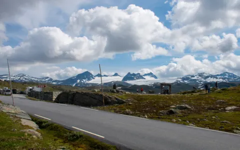 Scenic RouteSognefjellet Scenic RouteStart of the route in Gaupne: 108 km over the highest mountain pass in northern Europe to Lom.
-
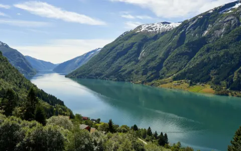 FjordSognefjordNorway’s longest and deepest fjord: 205 km from the coast to the glaciers, up to 1.308 metres deep.
-
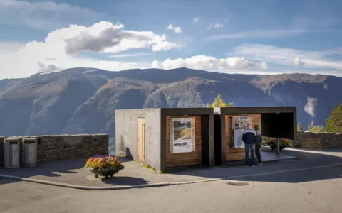 Special ToiletStegastein viewpoint – AurlandViewing platform 650 metres above the Aurlandsfjord, with a toilet building that hangs over the edge of the cliff.
-
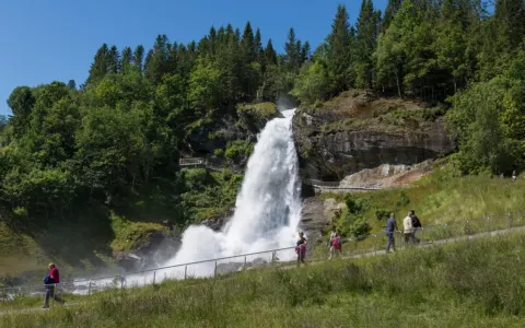 WaterfallSteinsdalsfossen – HardangerWalk behind the curtain of water – a short stop on Rv7 just outside Norheimsund.
-
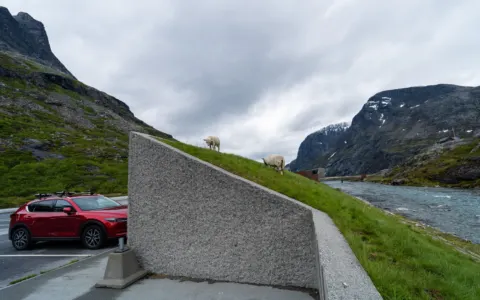 Special ToiletTrollstigen viewpointViewing platforms 200 metres above the Trollstigen hairpins, and a toilet building where sheep sometimes graze on the roof.
-
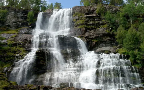 WaterfallTvindefossen – VossA wide, many-stepped waterfall right by the E16 north of Voss – a quick stop on the way to Flåm.
-
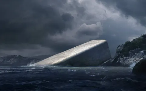 Landmark / POIUnderwater Restaurant - Under - LindesnesUnder at Lindesnes, described as Europe’s first and the world’s largest underwater restaurant: seafood five metres below the surface, wit…
-
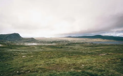 Scenic RouteValdresflye Scenic RouteStart of the route at Garli: 49 km above the treeline across Valdresflye to Hindsæter, with Jotunheimen in view.
-
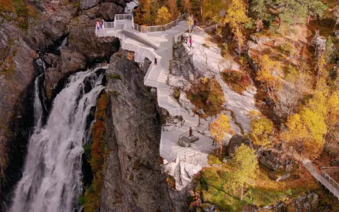 WaterfallVøringsfossen – HardangerviddaNorway's famous waterfall, 182 metres into Måbødalen, with safe paths, viewpoints, a step bridge and two service buildings.
Central Norway 8
-
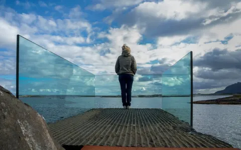 Landmark / POIAskevågen – Atlantic RoadA glass-walled platform at the end of a breakwater, open to the ocean.
-
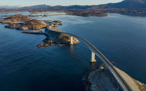 Scenic RouteAtlanterhavsvegen – The Atlantic RoadEight bridges across the open sea – one of the world’s most famous drives.
-
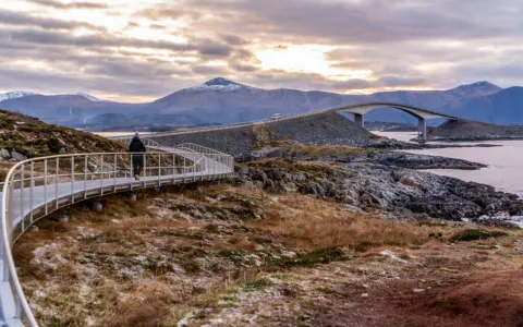 Landmark / POIEldhusøya – Atlantic RoadA walkway around the island with the classic view of Storseisundbrua.
-
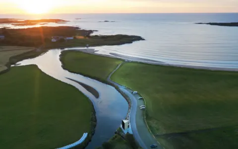 Special ToiletFarstadsanden – Atlantic RoadA long sandy beach on Hustadvika, with toilets open all year.
-
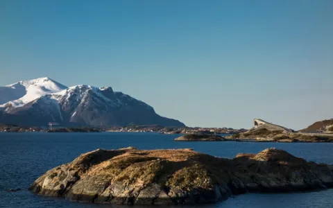 Landmark / POIGeitøya – Atlantic RoadShort walks, an accessible fishing spot and the boat to Håholmen.
-
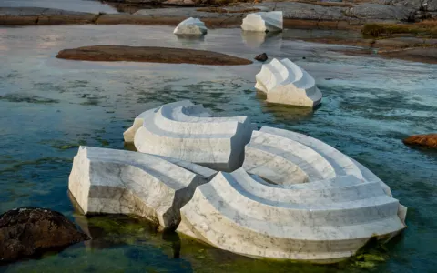 Landmark / POIHågå – Atlantic RoadA coastal path with the marble sculpture Columna Transatlantica.
-
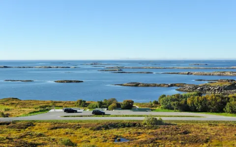 Landmark / POIKjeksa – Atlantic RoadA rest area above Hustadvika near Bud, with steps down to the sea.
-
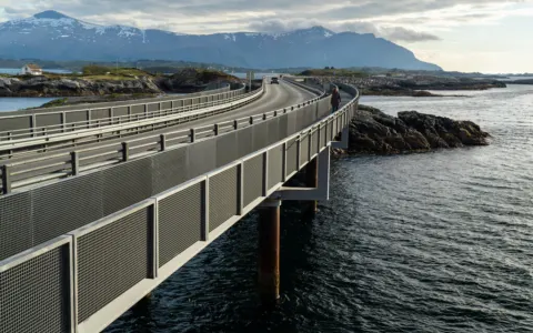 Landmark / POIMyrbærholmbrua – Atlantic RoadFishing walkways in the tidal current, right beside the road.
Helgeland, Nordland and Vesterålen 11
-
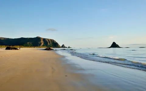 Scenic RouteAndøya Scenic Route and BleikStart of the route at Bjørnskinn: 58 km along the outer coast of Andøya to Andenes, past the white beach at Bleik.
-
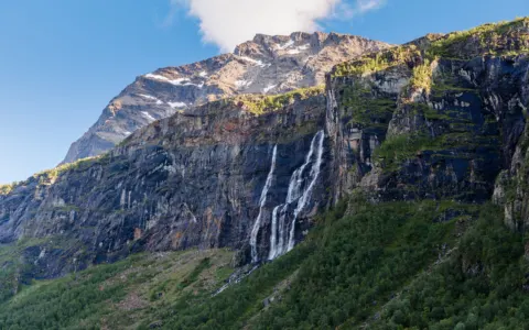 WaterfallHenrikafossen – SpansdalenA waterfall of about 250 metres in Spansdalen, Lavangen. Park at Holmeveien 34; the path over the Midnight Sun Stairs leads to the falls.…
-
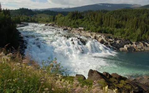 WaterfallLaksforsen – GraneA broad, 17 metre waterfall in the Vefsna river, right by the E6 north of Trofors.
-
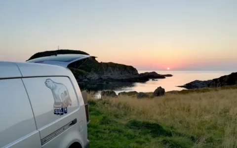 Landmark / POINyksund VesterålenWild camp spot by the sea, close to Nyksund.
-
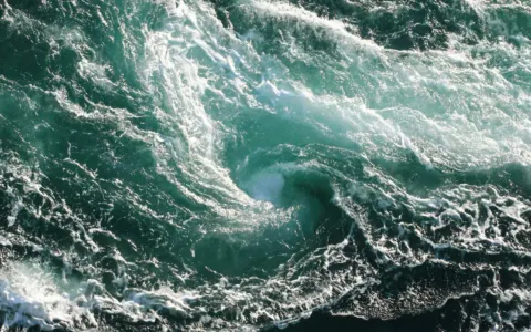 Landmark / POISaltstraumen – BodøOne of the world’s strongest tidal currents: up to 20 knots and whirlpools up to 10 metres wide, 33 km from Bodø.
-
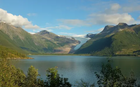 Landmark / POISvartisen Glacier – Engabreen and AusterdalsisenNorway’s second-largest mainland glacier, reached by a short boat ride and a walk – Engabreen from the Coastal Route, Austerdalsisen from…
-
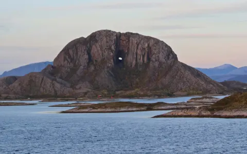 Landmark / POITorghatten – BrønnøysundThe mountain with a hole: walk through the 160 metre tunnel the sea carved through Torghatten, just south of Brønnøysund.
-
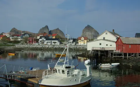 Landmark / POITræna – HelgelandA remote island community far out on the Helgeland coast – best visited without the camper, by ferry or express boat.
-
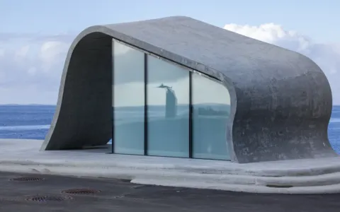 Special ToiletUreddplassen – Helgeland CoastRest stop on the coastal road Fv17 with one of Norway's best-known toilets, a wide terrace over the sea and a memorial to the submarine U…
-
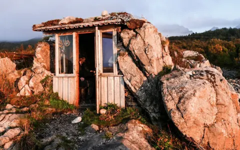 Landmark / POIUværshula - VesterålenSmall cabin built by a local between two big rocks to watch bad weather.
-
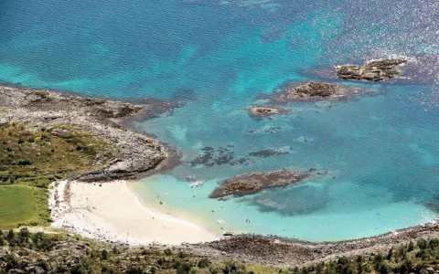 Landmark / POIVega Archipelago – World HeritageSome 6.500 islands just south of the Arctic Circle, a UNESCO World Heritage Site since 2004 – with the eider duck tradition and the Vega…
Lofoten 5 Everything in Lofoten ›
-
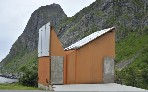 Special ToiletAkkarvikodden – LofotenRest stop on the E10 across Moskenesøya with a sculptural service building shaped like the steep Lofoten peaks around it.
-
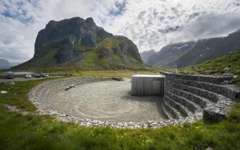 Special ToiletEggum rest stop – LofotenAmphitheatre-shaped rest stop by the open sea at the fishing village of Eggum, with toilets, a kiosk and the sculpture Hode.
-
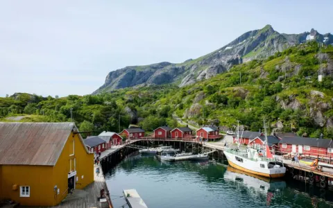 Landmark / POINusfjord – LofotenOne of Norway’s oldest and best-preserved fishing villages, 6 km off the E10 on Flakstadøya.
-
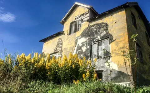 Landmark / POIPøbel Street Art GimsøyA street art piece of the Norwegian artist Pøbel.
- WaterfallSørvågen Waterfalls – LofotenCascades on the Munkebu trail just outside Sørvågen, a short walk from the hikers' car park. A summer walk: steep, wet rock off the main…
Senja 5 Everything in Senja ›
-
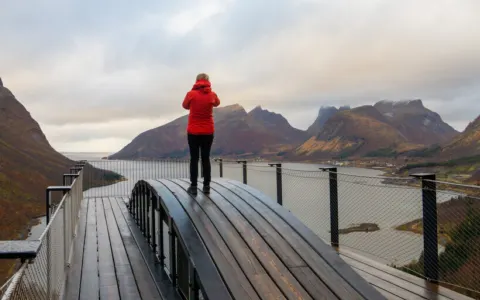 Landmark / POIBergsbotn Viewpoint – SenjaA 44 metre viewing platform above the Bergsfjord on the National Tourist Route Senja.
-
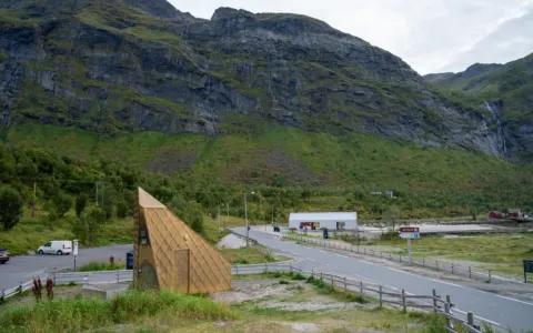 Special ToiletErsfjordstranda – SenjaWhite sand beach in the Ersfjord on Senja with the gold-clad toilet Gulldassen and a new service building with kiosk and outdoor shower.
-
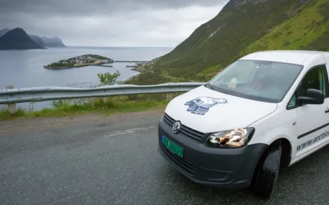 Landmark / POIHusøy SenjaA fishing village installed onto a little island in the fjord. It is a nice drive through the mountains to reach Husøy.
-
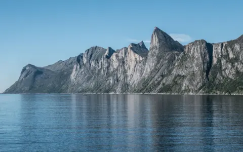 Landmark / POISegla SenjaA roadside view across Mefjorden to Segla, Senja’s famous peak – an easy stop by camper. The summit hike is a separate summer trip.
-
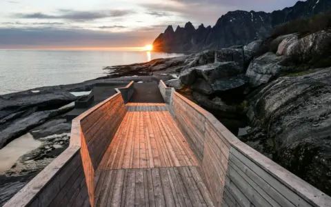 Landmark / POITungeneset SenjaRest stop on the tip of a headland on Senja, with a larch walkway over the rocks towards the open sea and the jagged peaks of Okshornan.
Tromsø and Troms 13 Everything in Tromsø and Troms ›
-
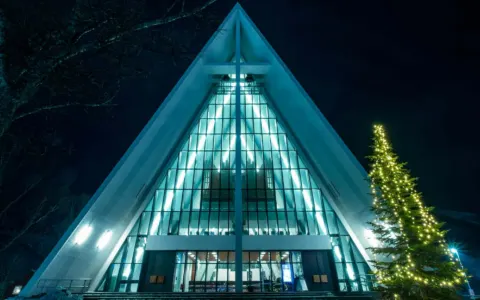 Landmark / POIArctic Cathedral – TromsøTromsø’s landmark church of 1965, with its white triangular roof and one of Europe’s largest glass mosaics.
-
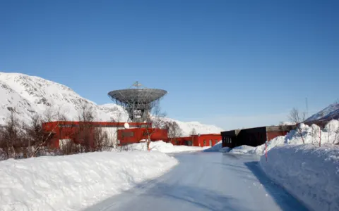 Landmark / POIEISCAT Research Station – TromsøGiant radar antennas in Ramfjord south of Tromsø, used to study the upper atmosphere and the processes behind the northern lights.
-
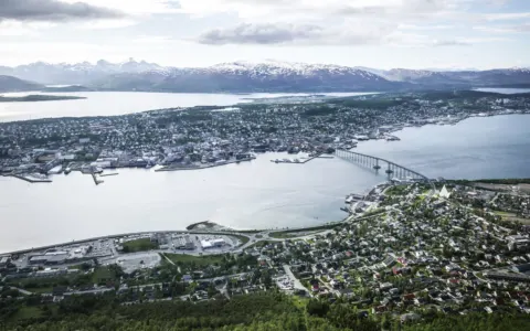 Landmark / POIFjellheisen TromsøThe Fjellheisen cable car runs from Tromsdalen up to Storsteinen (421 m) in four minutes, with a view over Tromsø island and the mountain…
- WaterfallFosselvfossen – StraumfjordA waterfall right by the E6 north of Storslett – seen from the road, best from above after a short, steep hike.
-
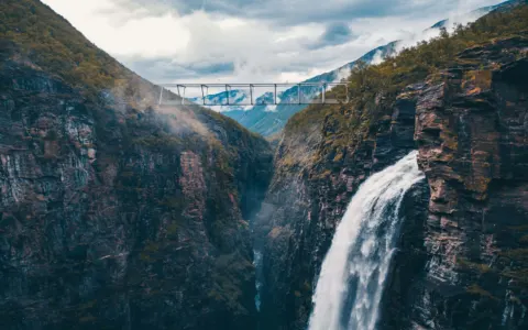 WaterfallGorsa Canyon and Gorzifossen Waterfall – KåfjorddalenA footbridge 153 metres above the Gorsa canyon beside the Gorzifossen waterfall, about 20–30 minutes on foot from the car park at Ankerli…
-
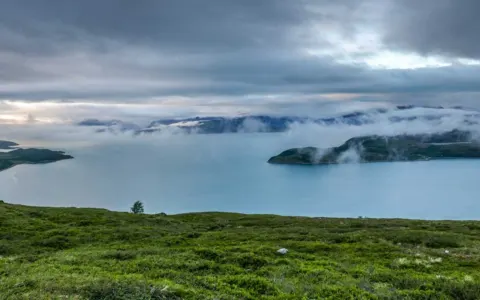 Landmark / POIKvænangsfjellet Nordreisa TromsGreat view from the mountain pass into the fjord. Check traffic information in winter time!
-
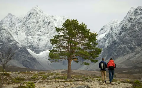 Landmark / POILyngen AlpsJagged peaks and glaciers rising straight out of the Lyngenfjord – hiking in summer, ski touring and Northern Lights in winter.
-
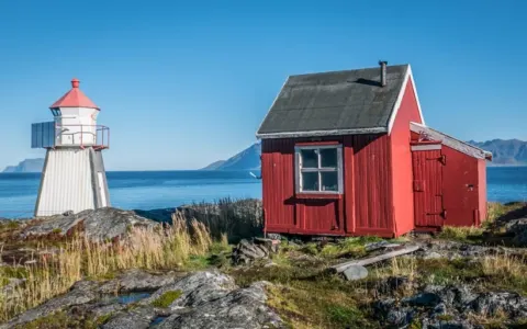 Landmark / POILyngstuva - Lyngen AlpsAn easy coastal walk of about 3,5 km each way from Russelv to the light at the northern tip of the Lyngen Peninsula, and a cabin from 192…
-
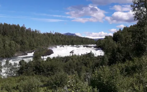 WaterfallMålselvfossen – MålselvNorway’s “national waterfall”: 600 metres of rapids in three falls in the Målselva, with a salmon ladder from 1910 that lets the salmon s…
-
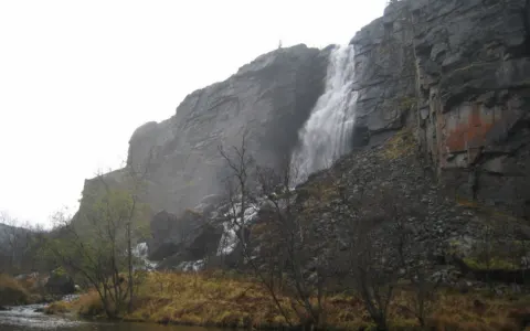 WaterfallMollisfossen – Reisa National ParkNorthern Norway’s highest waterfall, 269 metres, deep in Reisa National Park: by riverboat from Saraelv or a 19 km hike. The pin marks th…
- WaterfallNavitfossen and Røykfossen – NavitdalenTwo waterfalls in Navitdalen near Sørstraumen in Kvænangen – one by the car park, the other less than 1 km up the path.
-
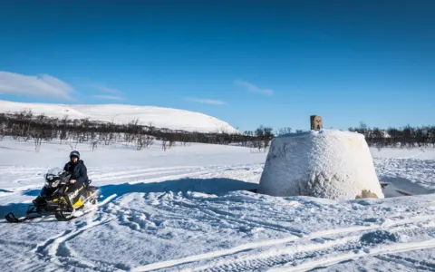 Landmark / POINordic TripointThe cairn where Norway, Sweden and Finland meet, in a lake near Kilpisjärvi: by boat and a 3 km walk in summer, on skis or a guided snowm…
-
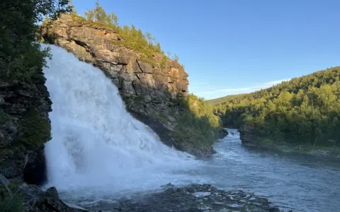 WaterfallRovijokfossen – SkibotndalenA 28 metre waterfall right by the E8 in Skibotndalen, with viewing platforms on both sides.
Finnmark 13 Everything in Finnmark ›
-
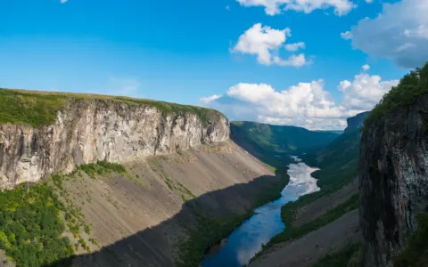 Landmark / POIAlta Canyon (Sautso)Northern Europe’s largest canyon: 300–420 metres deep and about 10 km long – a 13 km hike to the edge, or a riverboat trip.
-
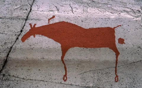 Landmark / POIAlta Rock Carvings – World HeritageAbout 6.000 rock carvings up to 7.000 years old by the Altafjord – a UNESCO World Heritage Site with an easy walk.
-
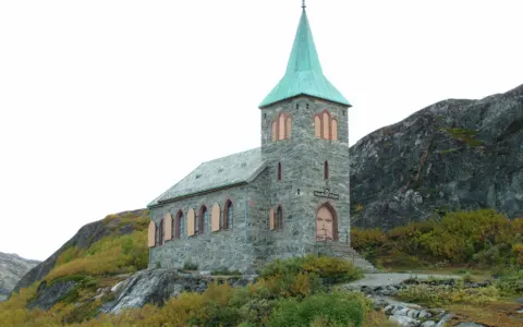 Landmark / POIGrense Jakobselv and King Oscar II ChapelWhere Norway meets Russia at the Barents Sea – a summer gravel road from Kirkenes and a stone chapel from 1869.
-
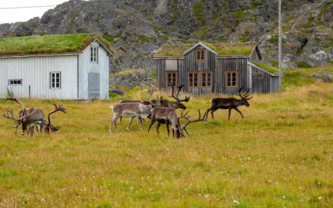 Landmark / POIHamningberg – VarangerAn old fishing village that survived the war, at the end of the National Tourist Route Varanger – through a lunar landscape on a summer-o…
-
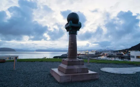 Landmark / POIMeridian Column – HammerfestThe northern end of the Struve Geodetic Arc, a UNESCO World Heritage Site: 2.820 km of measuring points from Hammerfest to the Black Sea.
-
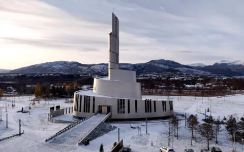 Landmark / POINordlyskatedralen AltaA church built in a modern style in the centre of Alta in Finnmark.
-
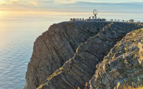 Landmark / POINorth Cape (Nordkapp)The famous cliff 307 metres above the Arctic Ocean at the end of the E69 – with the globe, the North Cape Hall and the midnight sun.
-
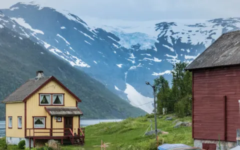 Landmark / POIØksfjordjøkul (Glacier)From here you have a great view towards the glacier tongue of the Øksfjordjøkul. Also the hiking trail starts here.
-
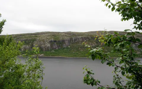 Landmark / POIPasvik Valley and Høyde 96Norway’s bear country on the Russian border: taiga forest, more than 220 bird species and a Cold War tower looking over to Nikel.
-
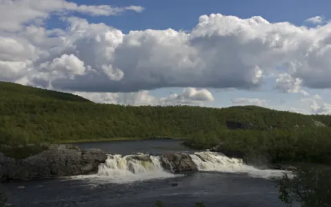 WaterfallPikefossen – KautokeinoAn 8 metre waterfall in the Kautokeino river with a Sámi legend, right by a rest area on the E45 across Finnmarksvidda.
-
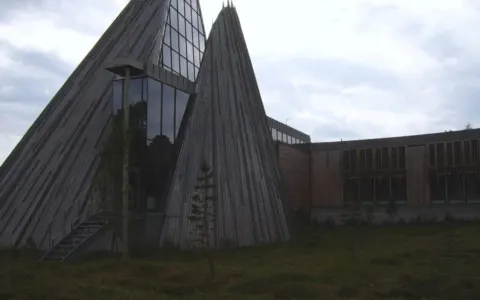 Landmark / POISámi Parliament – KarasjokThe Sámediggi in Karasjok, opened in 2000, with a plenary hall shaped like a lávvu – free guided tours.
-
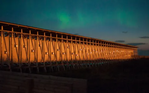 Landmark / POISteilneset Memorial – VardøA memorial by Peter Zumthor and Louise Bourgeois to the 91 people burned in Finnmark’s witch trials – always open.
-
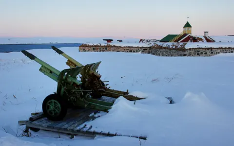 Landmark / POIVardøhus Fortress – VardøThe star-shaped fortress of 1734–38 at Norway’s northeastern frontier, which salutes the return of the sun every winter.