

Photos: Sissssou (CC BY-SA 3.0), Lukas Beck (CC BY 4.0), Palickap (CC BY-SA 4.0) · Wikimedia Commons
1 / 3Jostedalsbreen National Park
About
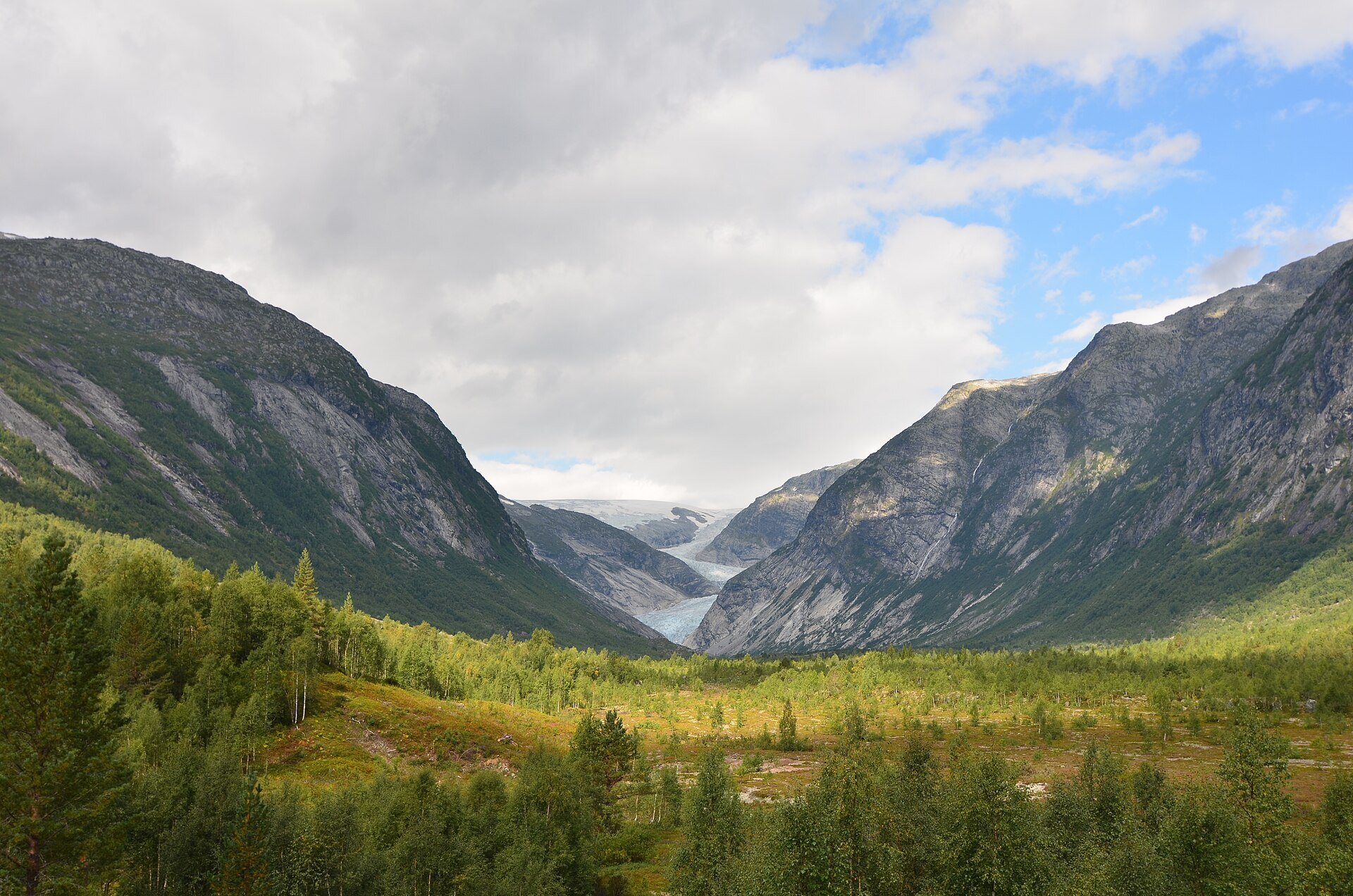
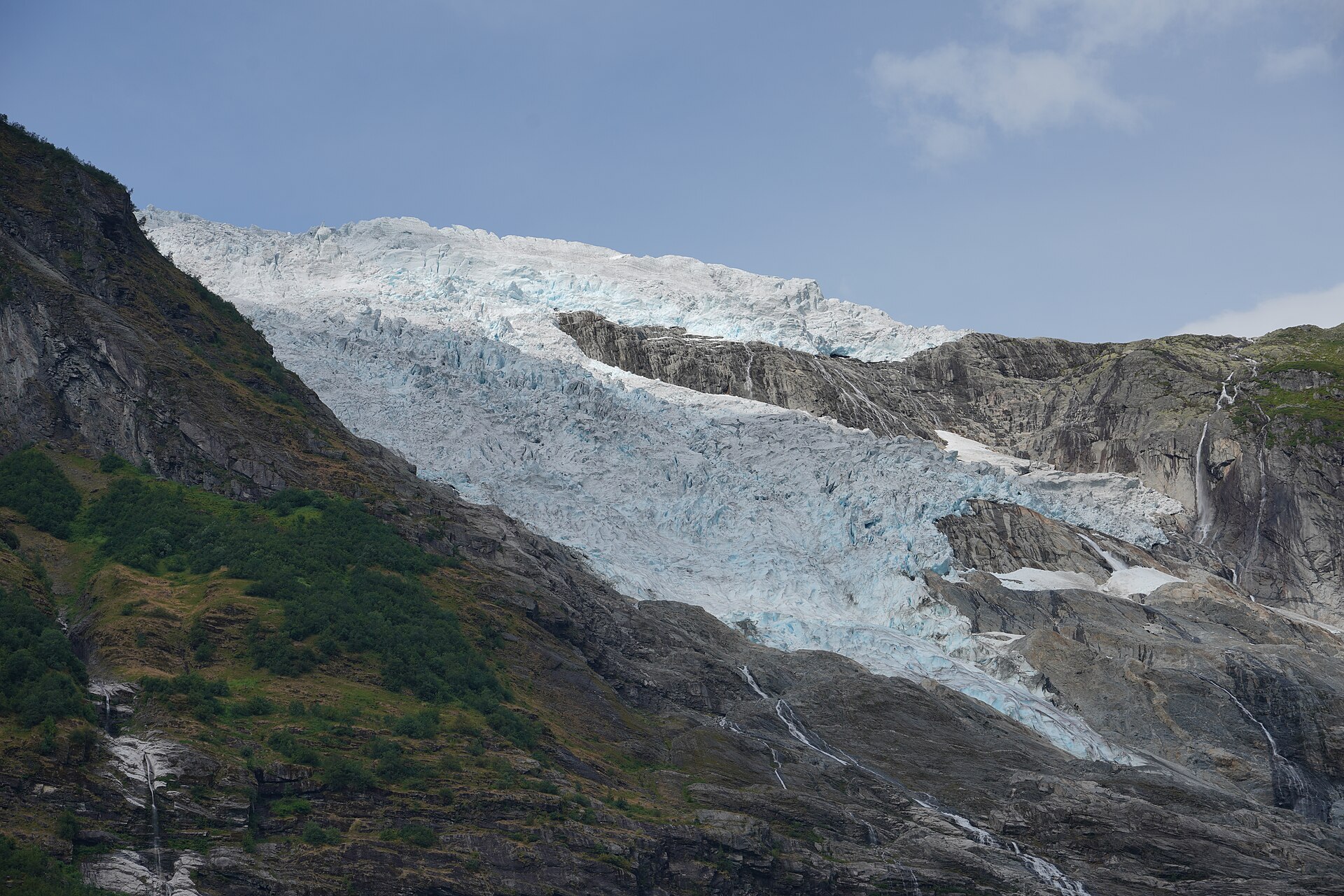
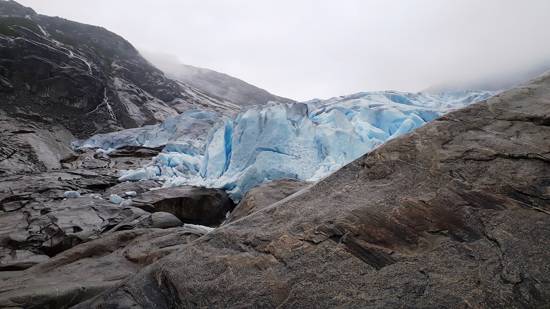
Jostedalsbreen is the largest glacier on the European mainland, a long ice cap on the ridge between Nordfjord and Sogn. The park around it was protected in 1991 and covers 1.314 km². The ice plateau itself rolls gently, highest at Breakulen (1.957 m), and is up to about 600 metres thick. From the edge, arms of blue, broken ice hang down into the valleys, some of them almost into the birch forest. The highest rock peak is Lodalskåpa (2.083 m) on the north-west side. The glacier is shrinking fast: measurements in 2020 suggested it could split into three smaller glaciers within about ten years.
Local knowledge: the glacier arm Nigardsbreen in Jostedalen is named after a farm it destroyed. In the cold years of the Little Ice Age the ice moved about 3 km down the valley. In 1735 the farmer Guttorm Johannesson Nigard stood before the autumn court, and his neighbours told how he and the farmers before him had to beg for bread and seed corn: the glacier lay a stone's throw from the farm and had crushed its meadows. The family left in 1738, the farm was struck from the tax list in 1742, and the year after the ice rolled over the farmyard. It stopped about 4,5 km in front of where its edge is today, and young forest now grows on the ground it left.
Visiting: follow Rv604 up Jostedalen from Gaupne to Breheimsenteret, the glacier centre with exhibitions and a free car park, where the pin is. From there the Brevegen toll road (closed in winter) runs about 3 km to the car park at Nigardsbrevatnet, the lake in front of the glacier. In summer a boat crosses part of the lake and the last bit takes about 40 minutes on foot. Walking from the car park to the viewpoint takes a little over an hour. Stay on the marked path: ice can fall from the front without warning, and calving and ice falls at Nigardsbreen have killed six people since 1986. Going onto the ice is for guided tours only. The other visitor centres are the Norwegian Glacier Museum in Fjærland, near the Bøyabreen arm, and the national park centre in Oppstryn. Places to stay nearby in our guide: Lyngmo Gjestehus og Camping and Uteplassen Sogndal, and the Sognefjellet Scenic Route starts not far away. More on the park's official page.

Weather & Northern Lights
Now
In 24 hours
Northern Lights Chances
Weather forecast from MET Norway (yr.no). An indication, not a promise: aurora activity over this place (NOAA) times the clear sky in the best three-hour window of the night (MET Norway). The next nights rest on the Kp forecast only. More: our Northern Lights Forecast and the Northern Lights Map.
Getting there
Breheimsenteret, 6871 Jostedal, Norway
Nearby
- Joker JostedalNearest shop · 2,3 km
- Toilets100 m
- Vinmonopolet LusterNearest Vinmonopolet · 27 km
- Solvorn Ferry QuayNearest ferry39 km
- Nigardsbreen CampingNearest campsite400 m
Data from OpenStreetMap (ODbL)
On the way
Road reports within 40 km and the nearest road cameras, from Statens vegvesen (NLOD). The pictures refresh every few minutes; the reports are put into English word by word. All road cameras
Reviews
Rate this place
You are, or have been here? Give it your stars.
Comments
Thank you! Your comment is shown once we have read it.
No comments yet.
Write a comment
Let us know your experience with this place -- did something change? Your comment is shown once we have read it.
Please write a few words.
Thank you -- that is enough for now. Please try again in an hour.