

Photos: Erik Fløan (CC BY-SA 4.0), Kjell Erik Pettersson (CC BY-SA 4.0), Cato Edvardsen (CC BY-SA 3.0) · Wikimedia Commons
1 / 3Stjørdal
About
Stjørdal lies at the inner end of the Stjørdalsfjord, an arm of the Trondheimsfjord, where the Stjørdalselva, one of Norway's big salmon rivers, runs out. The town is built on a flat sandy plain on the north side of the river mouth, and just south of it is Trondheim Airport Værnes, so for a lot of travellers this is the first bit of Norway they see.
Since it got town status in 1997 the town is officially Stjørdal, but Kartverket and Statistics Norway still use the old name, Stjørdalshalsen, and locals just say Halsen, after the tongue of land it stands on. In the sagas the valley is Stjóradalr, the first part probably an old name for the river. Equinor runs its Norwegian Sea fields from here, and some 900 people work for staffing firms, one of them hiring out nurses and doctors all over Norway.
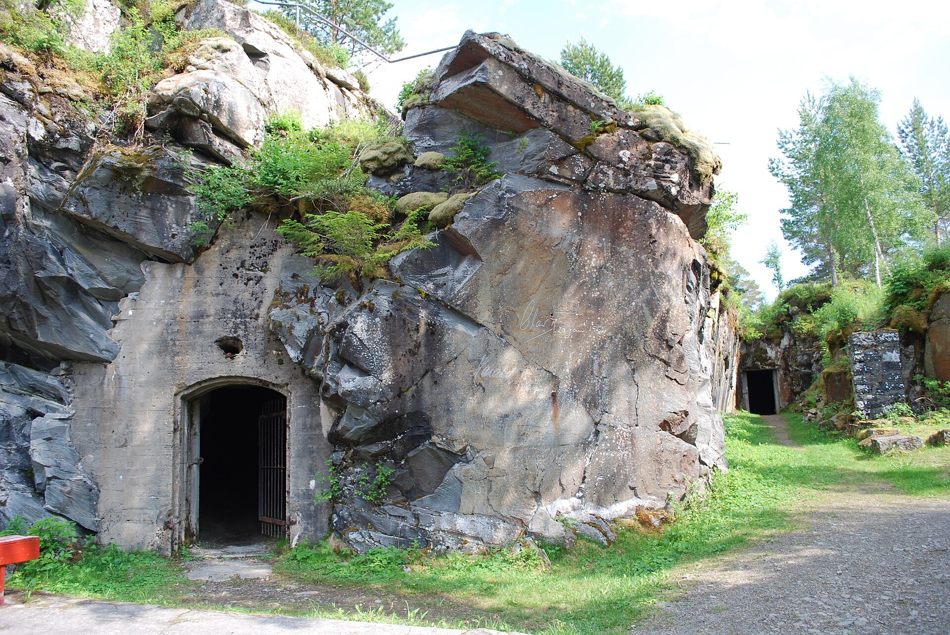
Local knowledge: the story everyone here knows is Hegra. Germany invaded on 9 April 1940, and the next day German troops took the airfield at Værnes. Major Hans Reidar Holtermann gathered what men he could and took them up the valley to Hegra, a fort from 1910 on a steep ridge, kept in reserve since 1926. Its guns had been taken down but were still stored there, and within days they were back in place. About 250 men held the fort, and one woman, Anne Margrethe Bang, a doctor's daughter who talked her way in and is remembered as "Lotta fra Hegra". From 14 April the Germans shelled and bombed it day and night. The defenders hoped to shell the runway at Værnes, but it was just out of range. Seven Norwegians were killed. On 5 May, surrounded and short of everything, they raised the white flag, the last regular Norwegian troops in southern Norway to give up.
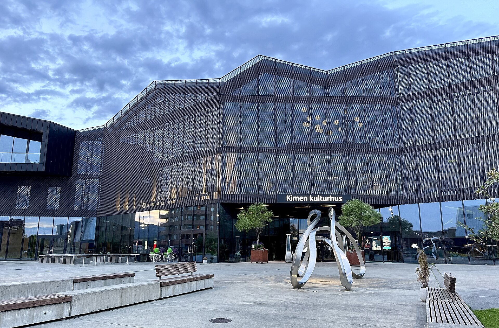
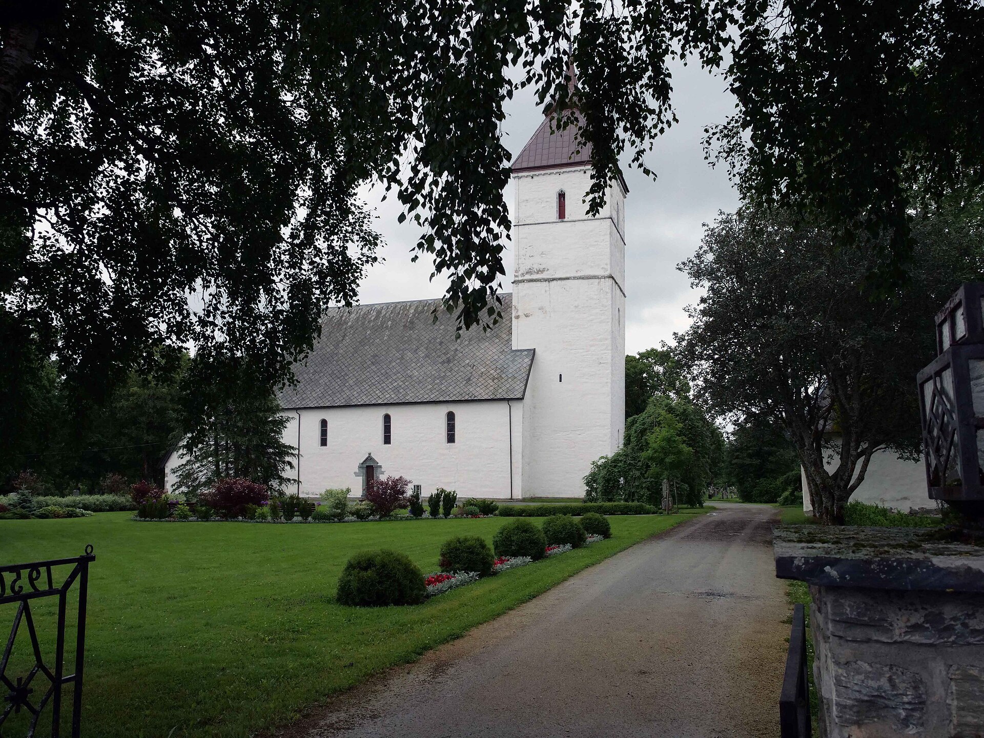
Visiting: the pin is on Orkesterplassen outside Kimen, the glass culture house in the centre, next to the pedestrian part of Kjøpmannsgata. On a rainy day, Kimen has the library and the cinema. Værnes church, by the airport, was built between about 1140 and 1190 and is the biggest country church in Trøndelag, almost unchanged since the Middle Ages. In the war the Germans nearly pulled the tower down because it was in the way of landing planes, and painted the church in camouflage instead. The grounds of Hegra fortress are open all year until the road closes for winter, the museum from mid-May to early October. Out in the Åsenfjorden lie the ruins of Steinvikholm, the castle where Archbishop Olav Engelbrektsson kept St Olav's shrine before he fled the country in 1537. For a hike, Skarvan og Roltdalen National Park reaches into the south-east corner of the municipality.
Fact sheet
- People: 16.061 in Stjørdal, 25.108 in Stjørdal municipality
- County: Trøndelag
- Town since: 1997
- Typical industries: staffing agencies, car sales and repair, restaurants and cafés
Population on 1 January 2026, from Statistics Norway. Typical industries are the ones with a much bigger share of the jobs here than in Norway as a whole (Statistics Norway, 2025).
Weather & Northern Lights
Now
In 24 hours
Northern Lights Chances
Weather forecast from MET Norway (yr.no). An indication, not a promise: aurora activity over this place (NOAA) times the clear sky in the best three-hour window of the night (MET Norway). The next nights rest on the Kp forecast only. More: our Northern Lights Forecast and the Northern Lights Map.
Getting there
Orkesterplassen, Kimen kulturhus, 7500 Stjørdal, Norway
Nearby
- Rema 1000 StjørdalNearest shop · 200 m
- St1 StjørdalFuel400 m
- Toilets300 m
- StjørdalNearest town300 m
- Vinmonopolet StjørdalNearest Vinmonopolet · 200 m
- Levanger Ferry QuayNearest ferry36 km
- Ertsgaard CampingNearest campsite4,7 km
Data from OpenStreetMap (ODbL)
On the way
Road reports within 40 km and the nearest road cameras, from Statens vegvesen (NLOD). The pictures refresh every few minutes; the reports are put into English word by word. All road cameras
Reviews
Rate this place
You are, or have been here? Give it your stars.
Comments
Thank you! Your comment is shown once we have read it.
No comments yet.
Write a comment
Let us know your experience with this place -- did something change? Your comment is shown once we have read it.
Please write a few words.
Thank you -- that is enough for now. Please try again in an hour.