

Photos: Tore Sætre (CC BY-SA 4.0) · Wikimedia Commons
Photos: Hongbin, Yogendra Negi · Unsplash
1 / 3Flåm
About
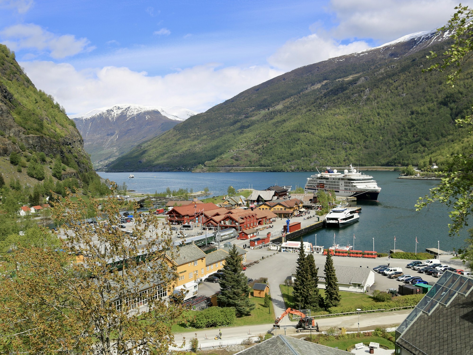
Flåm sits at the very end of the Aurlandsfjord, an arm of the Sognefjord, where the narrow valley Flåmsdalen opens out onto a small patch of flat land by the water. Arrive in summer and the harbour is the first thing you see: the station with its green trains, red and brown wooden buildings, fjord boats at the quay and often a cruise ship bigger than the village itself.
Fewer than 300 people live here, and almost all of them live from visitors. The deep-water quay by the station takes the largest cruise ships, and on busy days the village is crowded. The name fits: it was written Flaam as early as 1340 and comes from Old Norse flá, a small flat between steep mountains.
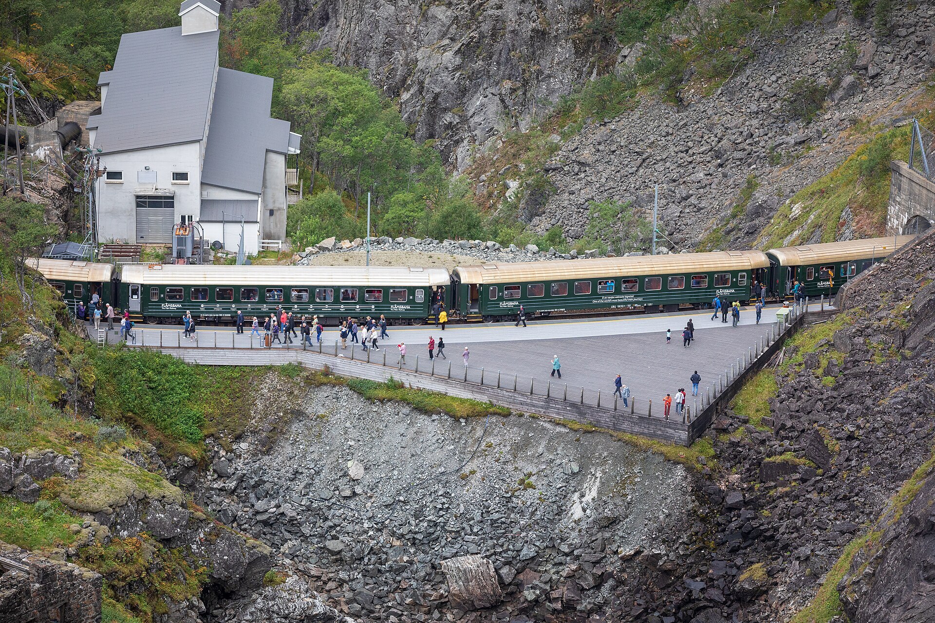
Local knowledge: the reason most people come is Flåmsbana, the Flåm Railway, which climbs about 865 metres in some 20 km to Myrdal on the Bergen Line. Building it was slow, hard work. Tunnelling started in 1924, and of the 20 tunnels only Nåli and Vatnahalsen were drilled by machine. The rest were drilled by hand, and the last was finished in 1935. At the upper end of the Vatnahalsen tunnel the cliff was so steep that the first workers had to be lowered on ropes. When Germany invaded in April 1940, Norwegian troops blew up the Blomheller tunnel. The occupiers then pushed the work on, and the first passenger trains, pulled by steam engines, ran on 10 February 1941. Because of the war there was never an opening ceremony, so the line was only opened officially at its 40th birthday in 1980. In 2024 it carried nearly 960.000 passengers.
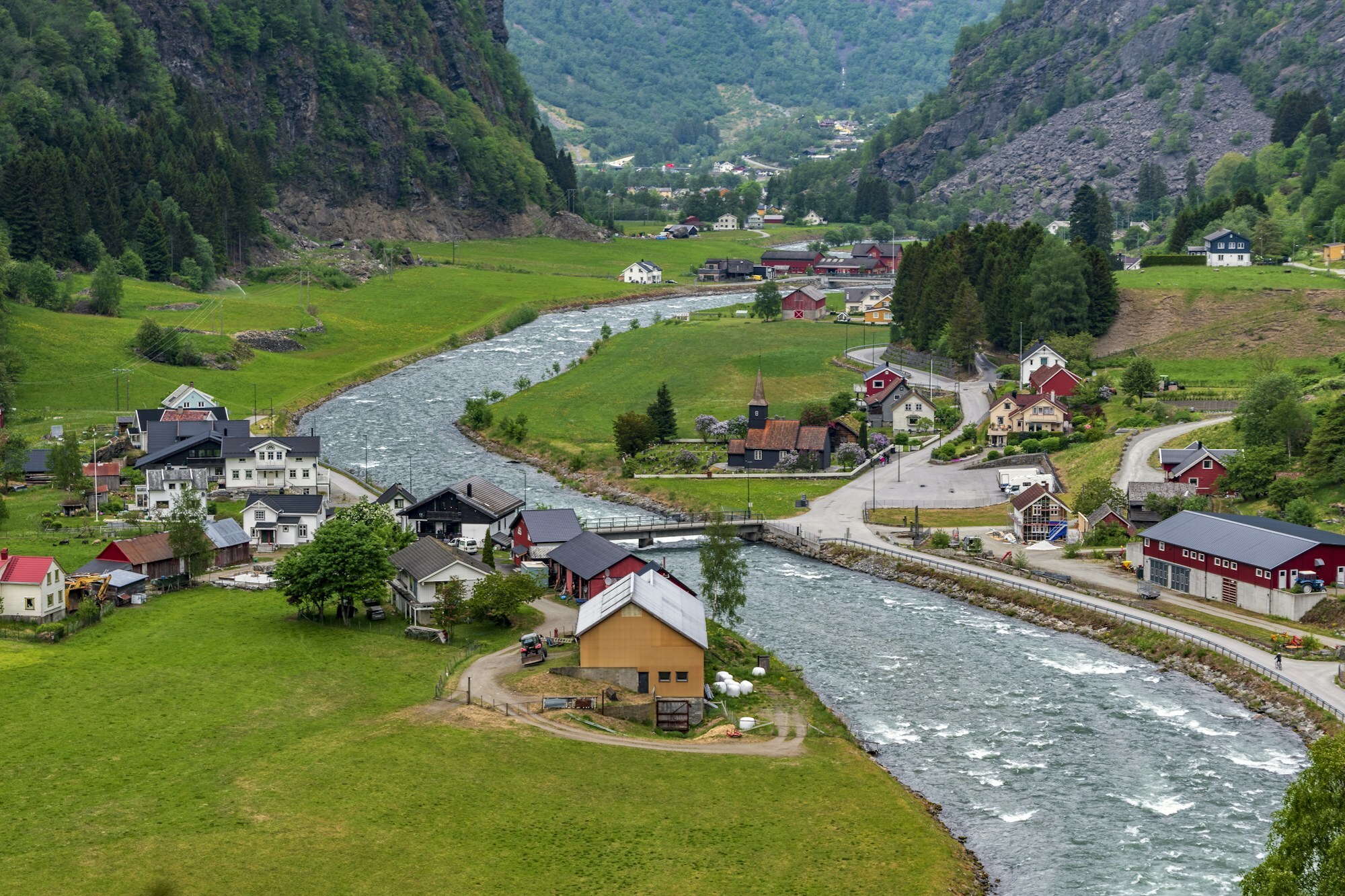
Born here: poet Per Sivle (1857–1904) was born on a farm near Flåm church, where a memorial to him stands. His patriotic poems helped rally Norwegians for the break with Sweden in the 1890s.
Visiting: the pin points to the Flåm Visitor Center by the station, the tourist information, where you get tickets for the railway and the fjord boats. On a rainy day, the Flåm Railway Museum in the old station building is free and has an El 9 locomotive built for this line. Or walk up the valley to Flåm church from 1670, a dark wooden church whose walls are painted with deer, lions, hares and foxes. The Gudvanga tunnel takes you to the Nærøyfjord, part of a UNESCO World Heritage site. Across the fjord, the Stegastein viewpoint sits on the Aurlandsfjellet Scenic Route high above Aurland.
Fact sheet
- People: 291 in Flåm, 1.866 in Aurland municipality
- County: Vestland
- Typical industries: tour operators and travel agencies, hotels and other accommodation, farming
Population on 1 January 2026, from Statistics Norway. Typical industries are the ones with a much bigger share of the jobs here than in Norway as a whole (Statistics Norway, 2025).
Weather & Northern Lights
Now
In 24 hours
Northern Lights Chances
Weather forecast from MET Norway (yr.no). An indication, not a promise: aurora activity over this place (NOAA) times the clear sky in the best three-hour window of the night (MET Norway). The next nights rest on the Kp forecast only. More: our Northern Lights Forecast and the Northern Lights Map.
Getting there
A-feltvegen 11, 5743 Flåm, Norway
Nearby
- Coop Marked FlåmNearest shop · 100 m
- Toiletsright here
- FlåmNearest village100 m
- Vinmonopolet AurlandNearest Vinmonopolet · 6,1 km
- Frønningen Ferry QuayNearest ferry27 km
- Flåm Camping og HostelNearest campsite300 m
Data from OpenStreetMap (ODbL)
On the way
Road reports within 40 km and the nearest road cameras, from Statens vegvesen (NLOD). The pictures refresh every few minutes; the reports are put into English word by word. All road cameras
Reviews
Rate this place
You are, or have been here? Give it your stars.
Comments
Thank you! Your comment is shown once we have read it.
No comments yet.
Write a comment
Let us know your experience with this place -- did something change? Your comment is shown once we have read it.
Please write a few words.
Thank you -- that is enough for now. Please try again in an hour.