

Røros
About
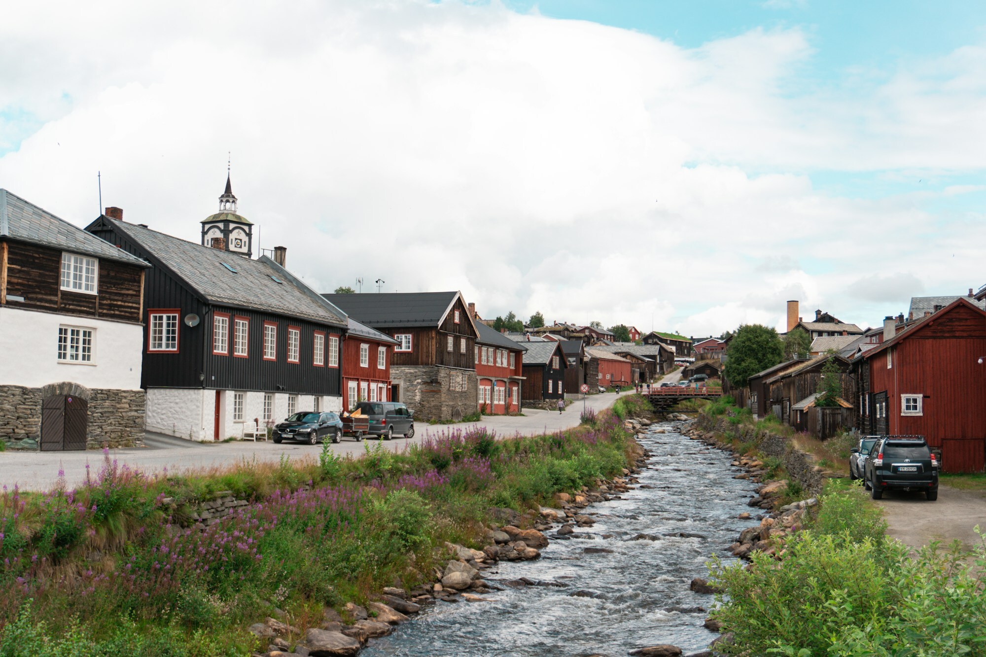
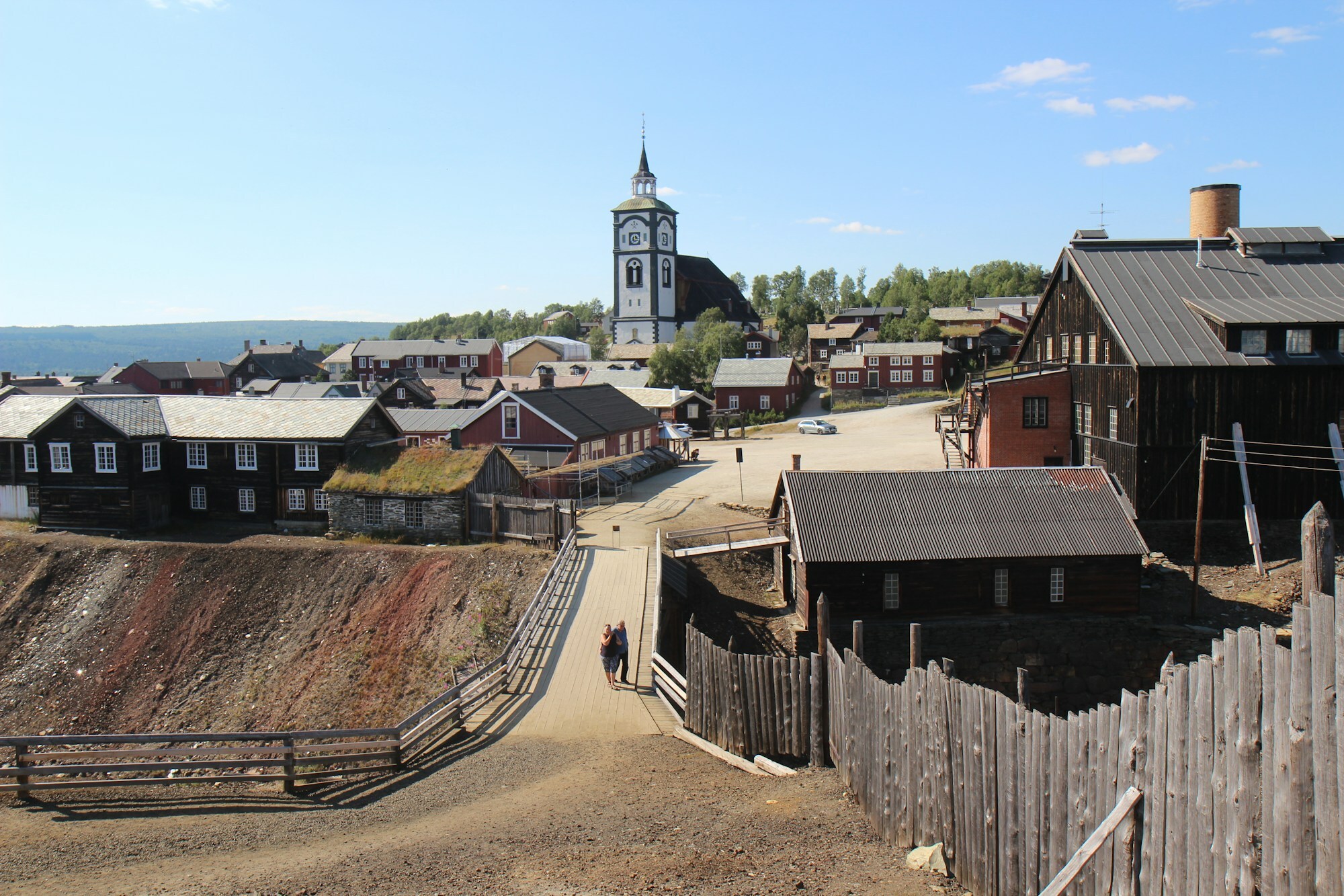
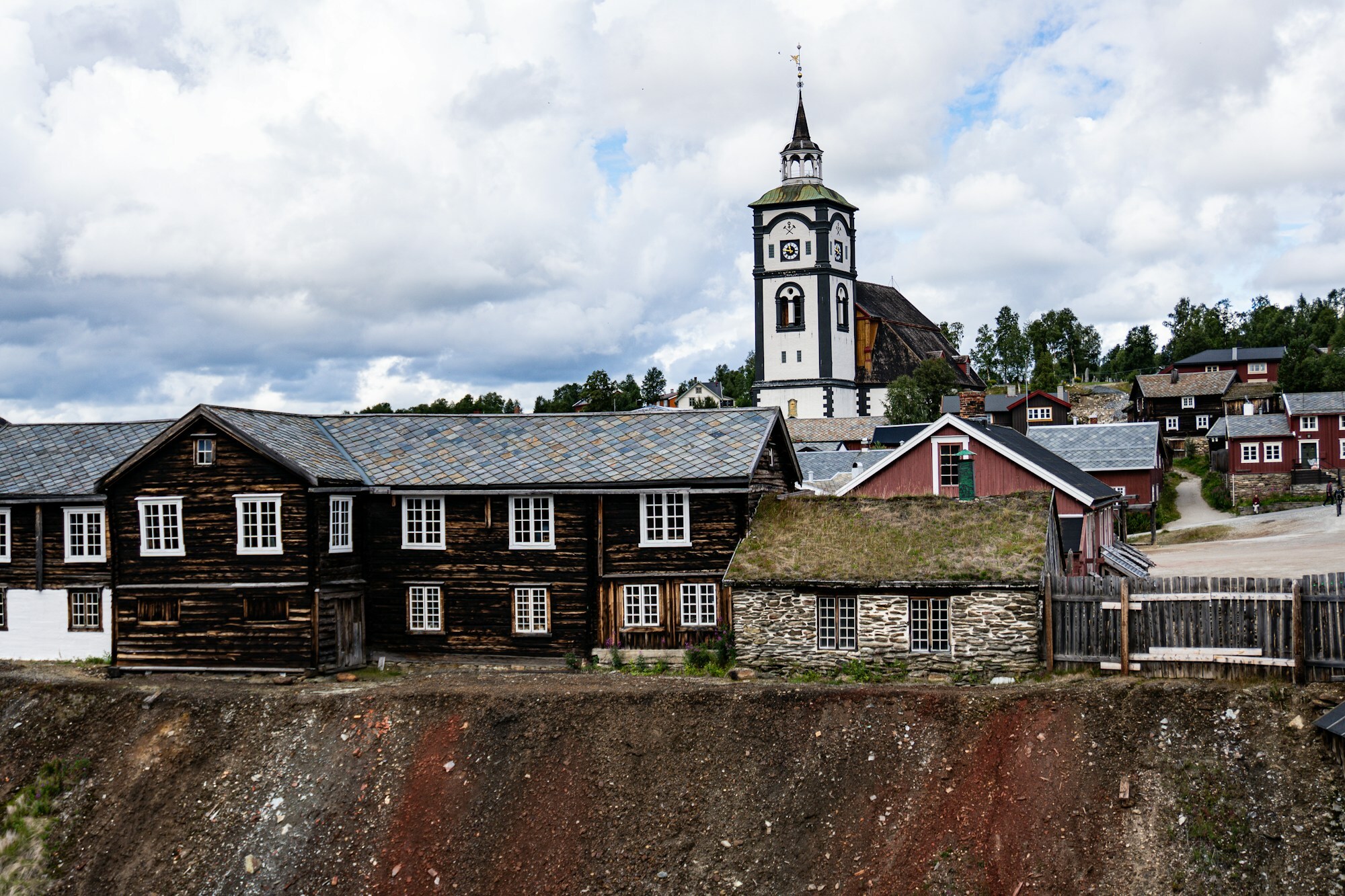
Røros sits 630 metres up on the mountain plateau near the Swedish border, and it looks like no other town in Norway. Log houses, many still dark and tarred, line Bergmannsgata and Kjerkgata, most of them built around small courtyards. Above them stands a white stone church, one of the largest in the country, and by the old smelter lie black and rust-red slag heaps from 300 years of copper smelting. In January 1914 it was more than 50 below zero here, still the cold record for southern Norway.
Today the town lives from visitors, farming and food, like the milk from the dairy Rørosmeieriet. It is also South Sámi land: in South Sámi the town is Plaassja, and the municipality has been officially bilingual, Røros – Rosse, since 2018. The Norwegian name comes from the farm Røros, Old Norse Røyðaróss, the mouth of the little river Røa where it meets the Glåma. Locals mostly call it Bergstaden, the mining town.
Local knowledge: they say a reindeer started it all: in the 1640s, when the farmer Hans Olsen Aasen was hunting at Storvola, a reindeer kicked up a stone glittering with copper ore. Legend or not, Aasen showed Lorentz Lossius where to dig, mining began in 1644, and two years later the first smelter was built by the river Hitterelva. For 333 years the town lived on copper. By 1670 the forest was cut down for 25 km around the smelter. The writer Johan Falkberget went down the mines at seven and later wrote his best-known novels about the miners. The last mine closed in 1977. In 1980 Røros went on UNESCO's World Heritage List, and in 2010 the listing grew to take in the Circumference, the circle of 45 km around the first mine that the king granted the copper works.
Born here: poet Paal Brekke (1923–1993) fled to Sweden at 17 during the war and came home to bring modernism into Norwegian poetry. Footballer Terje Kojedal (born 1957) won 66 caps and captained Norway's Olympic team in 1984.
Visiting: the pin points to the tourist information in Peder Hiortgata, in the middle of the old town. From there it's a few minutes to the slag heaps, and up Kjerkgata to the church, Bergstadens Ziir, finished in 1784. On a rainy day, go into Smelthytta, a copy of the old smelting house by the slag heaps, where Rørosmuseet tells the story of the copper works. Outside town, Olavsgruva has guided tours into an old mine. Campers can park at Røros IL Bobilparkering, a short walk from the centre, and two national parks reach into the municipality: Femundsmarka and Forollhogna.
Fact sheet
- Other official names: Plaassja (South Sámi)
- People: 3.871 in Røros, 5.638 in Røros municipality
- County: Trøndelag
- Typical industries: hotels and other accommodation, food production, such as the dairy Rørosmeieriet, farming
Population on 1 January 2026, from Statistics Norway. Typical industries are the ones with a much bigger share of the jobs here than in Norway as a whole (Statistics Norway, 2025).
Weather & Northern Lights
Now
In 24 hours
Northern Lights Chances
Weather forecast from MET Norway (yr.no). An indication, not a promise: aurora activity over this place (NOAA) times the clear sky in the best three-hour window of the night (MET Norway). The next nights rest on the Kp forecast only. More: our Northern Lights Forecast and the Northern Lights Map.
Getting there
Peder Hiortgata 2, 7374 Røros, Norway
Nearby
- Coop Mega RørosNearest shop · 100 m
- Esso RørosFuel300 m
- Toilets100 m
- RørosNearest townright here
- Vinmonopolet RørosNearest Vinmonopolet · 100 m
- Røros camping (previously Håneset camping)Nearest campsite1,8 km
Data from OpenStreetMap (ODbL)
On the way
Road reports within 40 km and the nearest road cameras, from Statens vegvesen (NLOD). The pictures refresh every few minutes; the reports are put into English word by word. All road cameras
Reviews
Rate this place
You are, or have been here? Give it your stars.
Comments
Thank you! Your comment is shown once we have read it.
No comments yet.
Write a comment
Let us know your experience with this place -- did something change? Your comment is shown once we have read it.
Please write a few words.
Thank you -- that is enough for now. Please try again in an hour.