

Åndalsnes
About
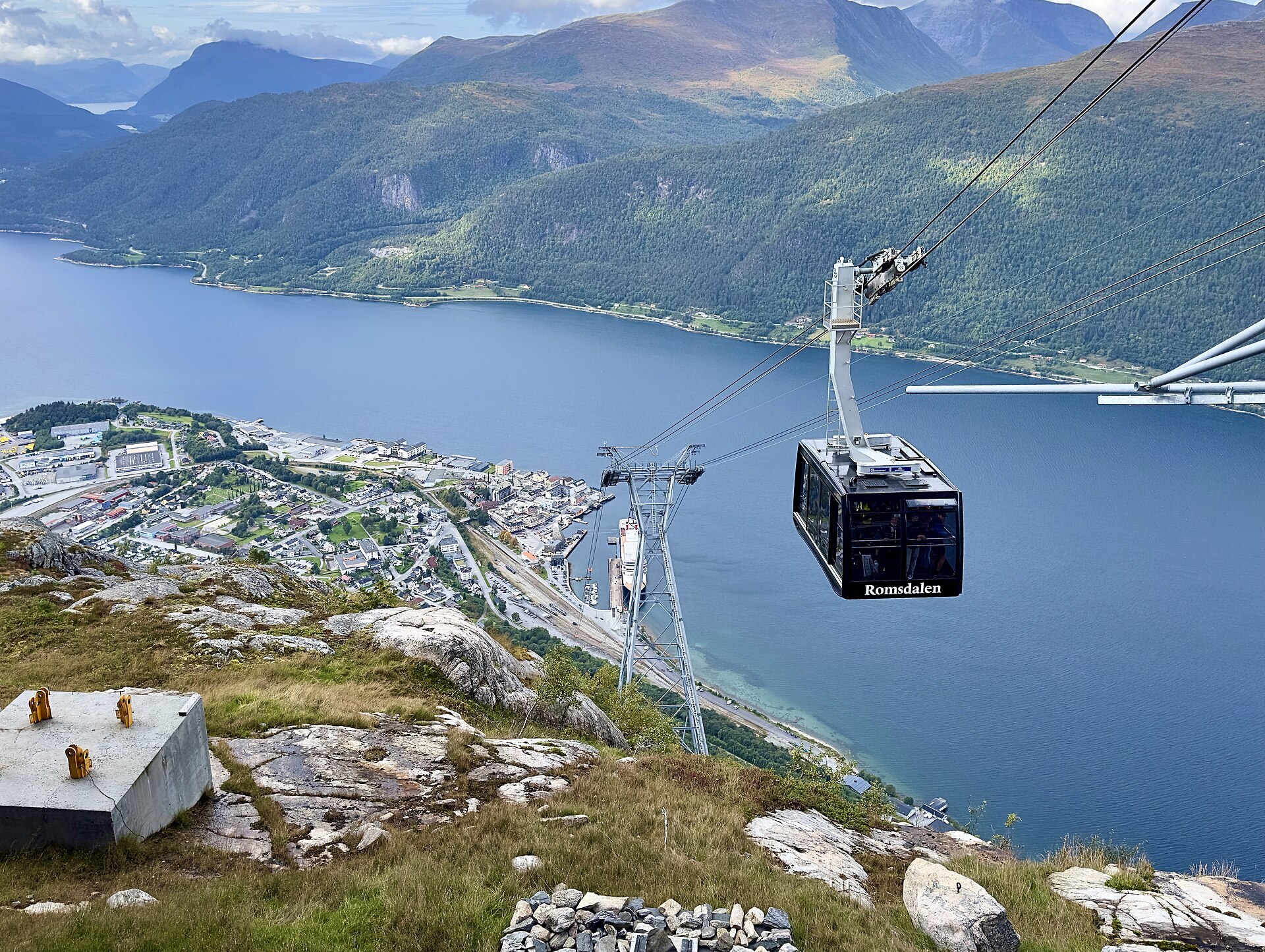
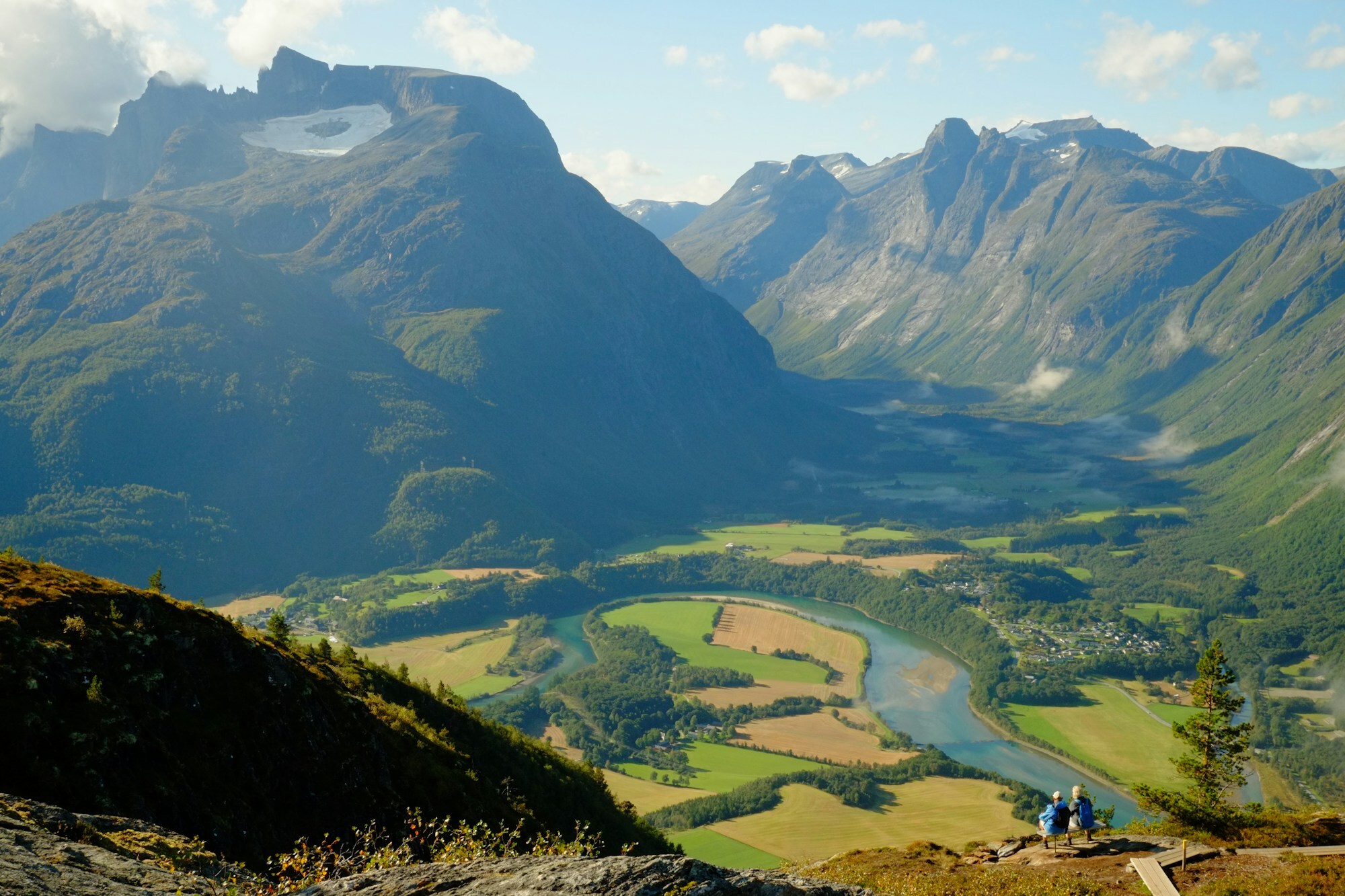
Åndalsnes lies on a flat sandbank where the river Rauma runs into the fjord, at the bottom of Romsdalen, and there are mountains on every side, up to 1.800 metres high. Right behind the houses Nesaksla rises to 715 metres, with a gondola to the top. The railway ends here too. The Rauma Line comes down from Dombås through Romsdalen, passes under the Troll Wall and Romsdalshornet, and stops by the quay.
It's a small town of 2.521 people, busy in summer with cruise ships, climbers and walkers, and the municipality calls it Norway's mountaineering capital. Off season it's a working town: the Wonderland bed factory has made beds here since 1969, and a lot of jobs are in road building and in trucking, buses and rail freight.
Local knowledge: locals still often just say Nes. The name joins two farms, Åndal and Nes, and was first used for the post office, Aandalsnæs, in 1888. Åndal may come from Old Norse ǫrn, eagle, or ámr, rust-red, nobody is sure. It grew after the railway came in 1924 and took the title of town in 1996. Its hardest weeks came in April 1940. British troops landed here in mid-April to help retake Trondheim from the Germans. On the evening of 20 April six railway wagons rolled in with Norway's gold reserve, brought by train from Lillehammer. That evening the German bombing began. The King and the Crown Prince passed through two days later. On the worst day 400 bombs fell. Part of the gold left on a British ship, the rest went on by lorry to Molde. When the British pulled out on 2 May, much of Åndalsnes lay in ruins.
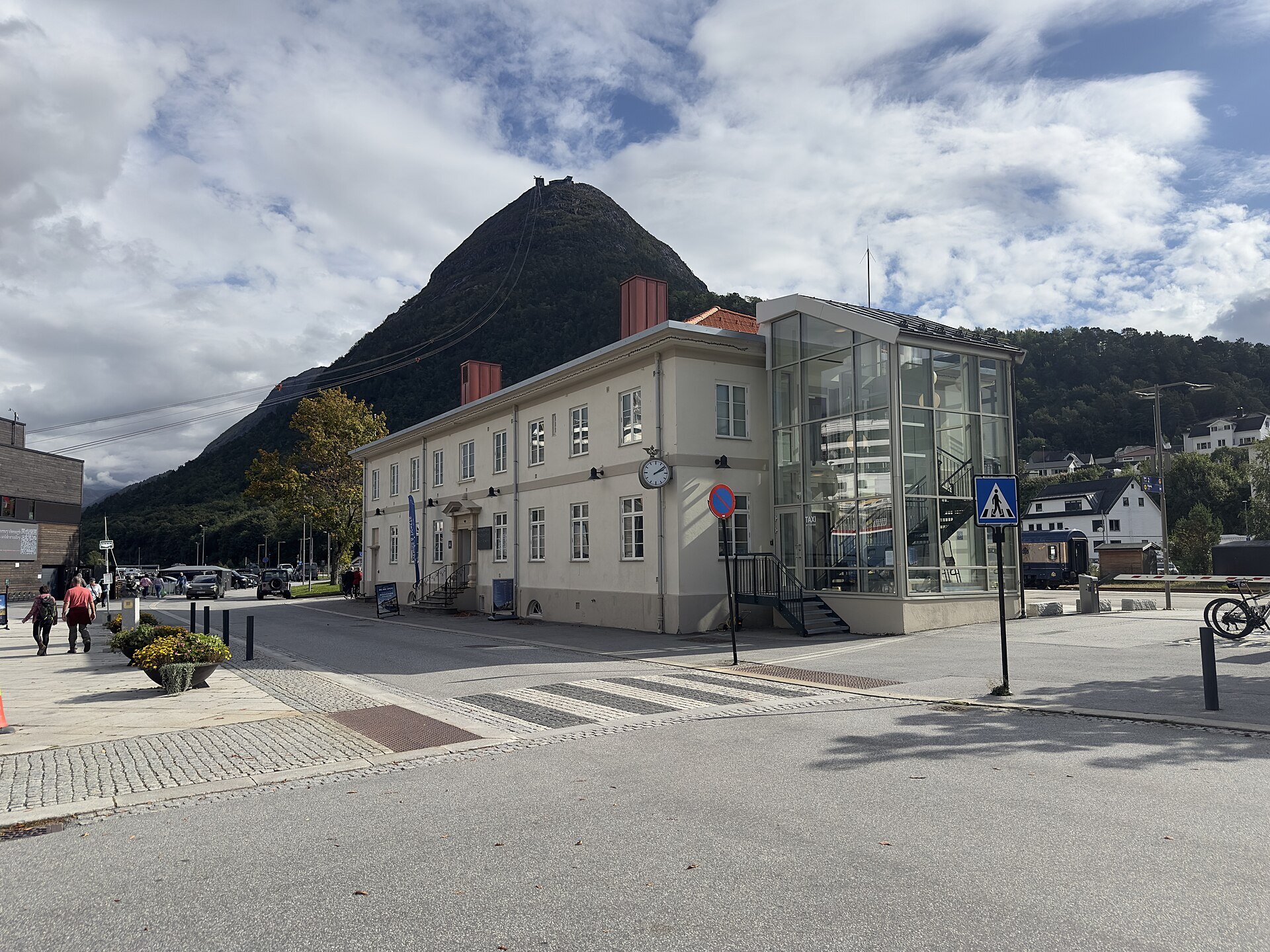
Visiting: the pin is at the railway station, the heart of the town. Next to it is the lower station of Romsdalsgondolen, five minutes up to Nesaksla. The top station sits on the path of Romsdalseggen, the 10 km ridge walk from Venjesdalen, so you can ride down at the end of the walk. You can also climb Romsdalstrappa, steps built by Sherpas from Nepal, to Rampestreken, a 20-metre steel platform whose last 8 metres hang out in the air above the town. On a rainy day, go to Norsk Tindesenter by the station: a climbing museum built on the collection of Arne Randers Heen, Norway's leading climber from the 1920s to about 1960, and the second-highest indoor climbing wall in Norway. Road 63 climbs south over Trollstigen, part of the Geiranger–Trollstigen Scenic Route, and the nearest campsites in our guide are Trollstigen Resort and Gjerdset Turistsenter.
Fact sheet
- People: 2.521 in Åndalsnes, 7.195 in Rauma municipality
- County: Møre og Romsdal
- Town since: 1996
- Typical industries: furniture: the Wonderland bed factory, road and civil engineering works, transport by road and rail
Population on 1 January 2026, from Statistics Norway. Typical industries are the ones with a much bigger share of the jobs here than in Norway as a whole (Statistics Norway, 2025).
Weather & Northern Lights
Now
In 24 hours
Northern Lights Chances
Weather forecast from MET Norway (yr.no). An indication, not a promise: aurora activity over this place (NOAA) times the clear sky in the best three-hour window of the night (MET Norway). The next nights rest on the Kp forecast only. More: our Northern Lights Forecast and the Northern Lights Map.
Getting there
Jernbanegata 1, 6300 Åndalsnes, Norway
Nearby
- Extra ÅndalsnesNearest shop · 300 m
- Uno-X Truck Veøy ÅndalsnesFuel900 m
- Toiletsright here
- ÅndalsnesNearest town200 m
- Vinmonopolet ÅndalsnesNearest Vinmonopolet · 300 m
- Åfarnes Ferry QuayNearest ferry14 km
- Bobilparkering Åndalsnes TindekaiaNearest motorhome park200 m
Data from OpenStreetMap (ODbL)
On the way
Road reports within 40 km and the nearest road cameras, from Statens vegvesen (NLOD). The pictures refresh every few minutes; the reports are put into English word by word. All road cameras
Reviews
Rate this place
You are, or have been here? Give it your stars.
Comments
Thank you! Your comment is shown once we have read it.
No comments yet.
Write a comment
Let us know your experience with this place -- did something change? Your comment is shown once we have read it.
Please write a few words.
Thank you -- that is enough for now. Please try again in an hour.