

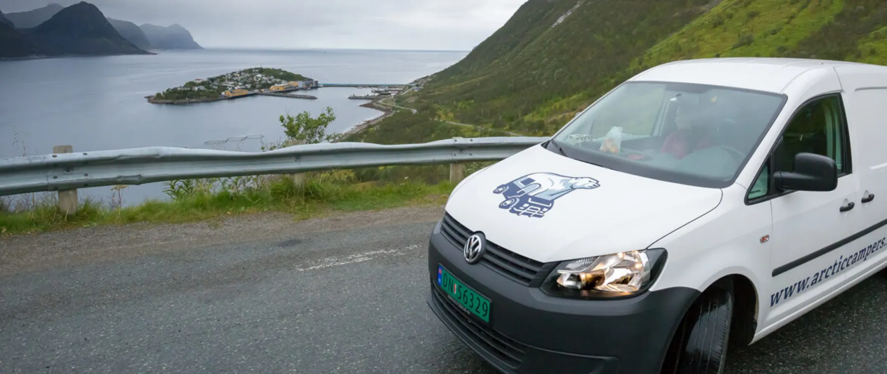
Roadtrip
Tromsø, Senja and Lofoten in 8 days
Eight days by camper from Tromsø: Senja's outer coast, the summer ferry to Andøya, Vesterålen, Lofoten to Å and back.
- 8 days
- 1.296 km
- ~23 h driving
- Tromsø ↺
- June – September
About this trip
Eight days from our depot in Tromsø, out along the scenic routes on Senja and Andøya, through Vesterålen and the length of Lofoten, then back by road. Three ferries you can't book set the pace, and no day has much more than 4,5 hours behind the wheel. It's a summer trip: the ferry from Senja to Andøya only runs from mid-May to late September.
The route at a glance
8 days · 1.296 km · ~23 h driving · 3 ferries
- 1Over the water to Senja118 km · ~1 h 57 min ·
- 2Senja's outer coast50 km · ~55 min
- 3Ferry to Andøya197 km · ~2 h 58 min ·
- 4Across to Lofoten174 km · ~3 h 10 min ·
- 5West along the E10137 km · ~3 h 8 min
- 6Reine, Sørvågen and back east156 km · ~2 h 49 min
- 7Off the islands244 km · ~4 h 8 min
- 8Målselvfossen and back to Tromsø220 km · ~3 h 58 min
Day 1
Over the water to Senja
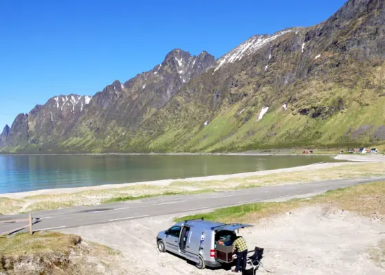
Pick up the van at Kvaløysletta and drive out across Kvaløya to Brensholmen, where the ferry takes you over to Botnhamn on Senja. From Botnhamn the National Tourist Route Senja runs 102 km along the outer coast to Gryllefjord, and you drive most of it in the next two days. Today it takes you out to the fishing village of Husøy on its little island, past the view of Segla and on to the beach in Ersfjord for the night.
-
Eurospar Kvaløysletta is 2,5 km from the depot and YX Kvaløysletta has fuel, so shop and fill up before you go. We also sell AGA gas bottles and freeze-dried meals at the depot.
-
2 Ferry
Brensholmen - Botnhamn Ferry
Ferry between the Tromsø area and Senja, all year with fewer trips in winter. Check the timetable.
This ferry runs all year and can't be booked, you just drive up and wait. In 2026 it leaves Brensholmen seven times a day Monday to Thursday and less often at the weekend, when locals fill it up, so come early. The crossing takes 45 minutes, and the fare is paid with AutoPASS and taken from your deposit after the rental.
- 29 km · ~17 min
-
3 Landmark / POI
Husøy Senja
A whole fishing village packed onto a little island in Øyfjorden – its people moved here in the 1950s; a causeway links it to Senja.
Stop for photos before you cross the 300 metre causeway, and keep clear of the narrow streets, driveways and fishing vehicles on the island. Husøy has a Joker shop, a café and a petrol station that only takes cards.
- 26 km · ~27 min
-
4 Landmark / POI
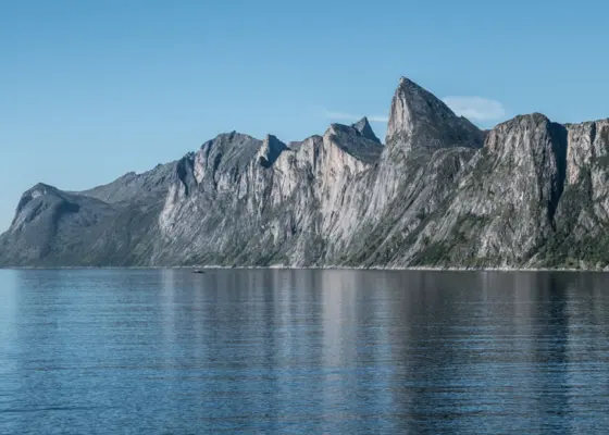
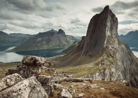
Segla Senja
A roadside view across Mefjorden to Segla, Senja’s famous peak – an easy stop by camper. The summit hike is a separate summer trip.
From the road near Senjahopen you look across Mefjorden to Segla without leaving the van. Tomorrow you can climb it.
Ersfjord is popular with locals too, so in summer get there early in the day. If it's full, the wild camp spot in Steinfjord is a few minutes away.
- 14 km · ~14 min
-
Sleep
Ersfjord Senja
Wild camp spot beside the beach. Nice view. Toilets 3 minutes' walk. Can be a busy place in summer.
Ferry on the way. Brensholmen - Botnhamn Ferry: next departures
Day 2
Senja's outer coast
Start on the white sand at Ersfjordstranda and walk out over the rocks on the walkway at Tungeneset. If the sky is clear and the snow has gone, drive back north to Fjordgård and climb Segla, the peak you saw from the road yesterday. In the afternoon follow the scenic route south past the platform at Bergsbotn to Torsken, a few minutes from tomorrow's ferry.
-
6 Landmark / POI
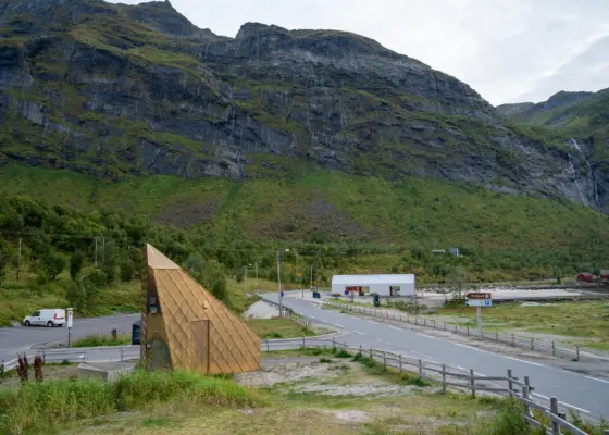
Ersfjordstranda – Senja
White sand beach in the Ersfjord on Senja with the gold-clad toilet Gulldassen and a new service building with kiosk and outdoor shower.
The golden toilet at Ersfjordstranda and the toilets at Tungeneset are open from early May to early October. Emptying camper toilets isn't allowed at the scenic route's rest stops; the dump stations are in Skaland, Senjahopen and Mefjordvær.
- 3,0 km
-
7 Landmark / POI
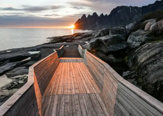
Tungeneset Senja
Rest stop on the tip of a headland on Senja, with a larch walkway over the rocks towards the open sea and the jagged peaks of Okshornan.
-
If you have time
Segla hike
The hike to the top of Segla from Fjordgård: about 4,5 km return, roughly 3,5 hours, steep. A summer hike, normally free of snow from mid-June to September.
Segla is 639 m, about 4,5 km there and back from Fjordgård, and takes 3 to 3,5 hours. Park only in the paid car park by the school, and drive slowly through the narrow Ørnfjord tunnel on the way in. There is usually snow at the top until about mid-June, and in snow or ice you don't go up.
- 14 km · ~17 min
-
8 Landmark / POI
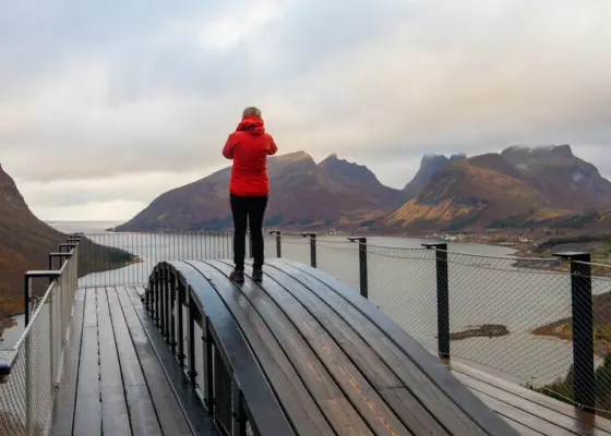
Bergsbotn Viewpoint – Senja
A 44 metre viewing platform above the Bergsfjord on the National Tourist Route Senja.
The 44 metre platform at Bergsbotn looks out over Bergsfjorden and is wheelchair accessible.
Senja Fjordcamp in Torsken is about 7 km from the ferry quay in Gryllefjord, so you can be in the queue early tomorrow.
- 32 km · ~34 min
-
Sleep
Senja Fjordcamp
Senja Fjordcamp is a camper-van site in Torsken on Senja, right down by the fjord, with a great view of the sea and the dramatic mountains.
Day 3
Ferry to Andøya
Today is ferry day. The boat from Gryllefjord crosses the open sea to Andenes at the top of Andøya, and we have seen whales from it more than once. From Andenes the National Tourist Route Andøya runs 58 km down the outer side of the island, past Bleik and its long white beach. If you want to go whale watching, stay at Andenes Camping tonight and drive the route tomorrow; otherwise carry on to Nyksund.
The Gryllefjord–Andenes ferry only runs in summer, in 2026 from 13 May to 27 September. It leaves Gryllefjord at 11:00 and 19:00, with an extra 15:00 departure from 15 June to 23 August. You can't book, and the ferry is small: in July be at the quay 2 to 3 hours before it leaves.
- 6,7 km · ~11 min
-
10 Ferry
Gryllefjord - Andenes Ferry
Ferry between Senja - Andøya (Vesterålen). Only operating in summer.
Outside the ferry season the way round is over the bridge at Finnsnes and south on the E6 and E10, about 445 km from Torsken to Andenes. Then it is better to leave out Andøya and go straight on to Lofoten.
-
If you have time
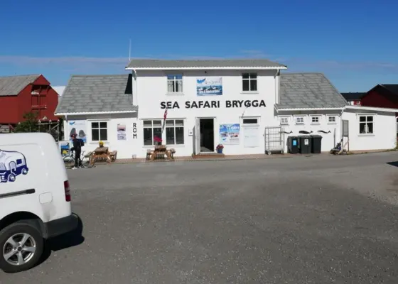
Sea Safari Andenes
Do a whale or bird watching trip from Andenes. Arctic Campers are getting a discount.
Sea Safari Andenes takes you out by RIB to look for humpback, fin and sperm whales, with 10 % off for Arctic Campers guests. Andenes Camping is the only campsite in Andenes.
- 88 km · ~54 min
-
11 Landmark / POI
Andøya Scenic Route and Bleik
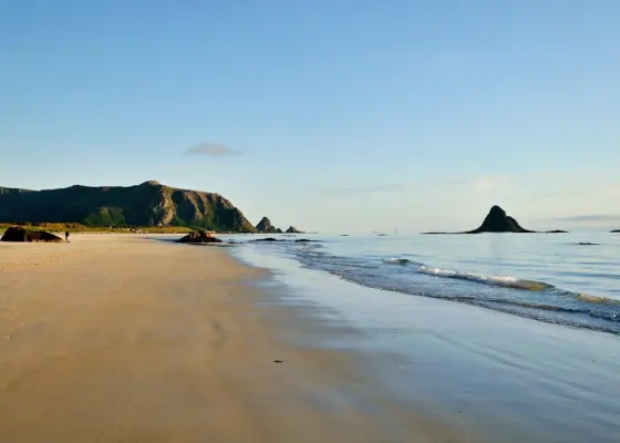
Start of the route at Bjørnskinn: 58 km along the outer coast of Andøya to Andenes, past the white beach at Bleik.
The road by Andøya Spaceport can be closed for up to 8 hours during a launch, so check the road reports on the route's page before you set off. Emptying toilets isn't allowed at the rest areas; the nearest dump station is in Andenes.
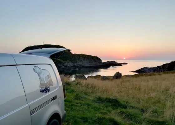
The camp spot at Nyksund is just before the bridge to the village, down an uneven track. The directions are on its page.
- 103 km · ~1 h 53 min
-
Ferry on the way. Gryllefjord - Andenes Ferry: next departures
Day 4
Across to Lofoten
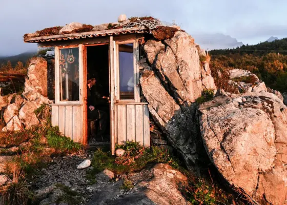
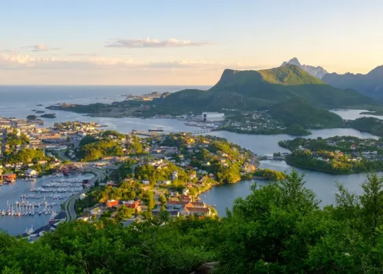
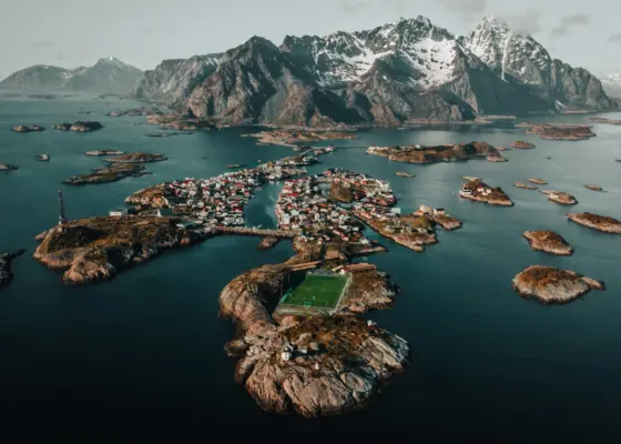
Drive south through Vesterålen to Hadseløya and stop at Uværshula, a tiny stone hut with a grass roof squeezed between two rocks above the shore. From Melbu the ferry takes you over to Fiskebøl in Lofoten. Then it's a short drive to Svolvær, the main town, and on over the bridges to Henningsvær, a fishing village built on a handful of rocky islands.
- 92 km · ~1 h 45 min
-
13 Landmark / POI
Uværshula - Vesterålen
A tiny stone hut between two rocks on the shore of Hadseløya, built by a local so he could watch storms from somewhere warm.
Look for the small sign by Fv881 near Teigan, park there and follow the narrow path down. Take your rubbish with you, and stay away when the waves are big.
- 14 km · ~16 min
-
14 Ferry
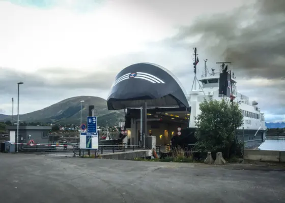
Melbu - Fiskebøl Ferry
Ferry connection between Vesterålen and Lofoten. It is a shortcut instead of driving round on the E10.
You can't book this ferry; AutoPASS registers the van as you drive on, and the crossing takes about 25 minutes. Driving round on the E10 instead takes much longer, so coming from the north the ferry is the better choice.
- 42 km · ~36 min
-
15 Towns & Places
Svolvær
Lofoten's main town, a fishing harbour spread over islands and bridges, with the two horns of Svolværgeita above the rooftops.
- 24 km · ~28 min
-
16 Towns & Places
Henningsvær
A Lofoten fishing village on low rocky islands below Vågakallen, with stockfish racks, wooden quays and a football pitch with sea on all sides.
- 3,2 km · ~5 min
-
Sleep
Daudmannssundet Lofoten
Camp site on the sea. Starting point for climbing routes. Just some minutes away from Henningsvær.
Ferry on the way. Melbu - Fiskebøl Ferry: next departures
Day 5
West along the E10
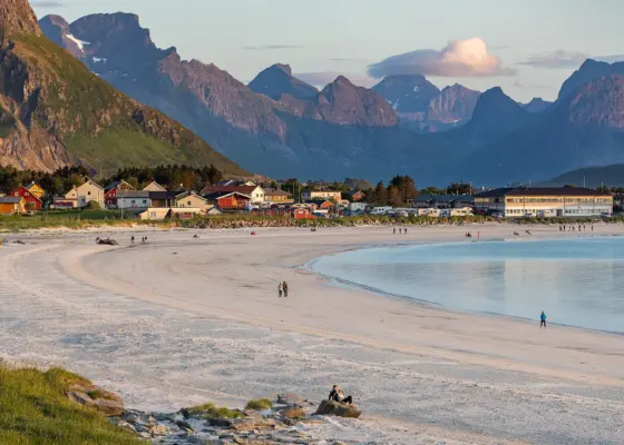
Follow the E10 west over Gimsøy and Vestvågøya, and take the side road out to Eggum, a fishing village alone between the sea and the mountains. Then cross to Flakstadøya and the long white beach at Ramberg, where Arctic Campers started in 2014 with five small vans. From about 27 May to 17 July the sun doesn't set here at all.
-
- 52 km · ~1 h 38 min
-
19 Landmark / POI
Eggum rest stop – Lofoten
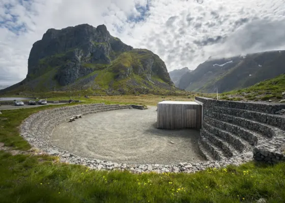
Amphitheatre-shaped rest stop by the open sea at the fishing village of Eggum, with toilets, a kiosk and the sculpture Hode.
The toilets at Eggum are open from early May to early October, and emptying camper toilets isn't allowed here. In summer people drive out for the midnight sun over the open sea.
-
If you have time
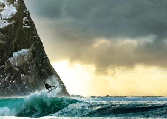
Unstad Arctic Surf Lofoten
The surf location of Lofoten. Rent boards, take lessons or book the hot tub. 10% discounts for Arctic Campers.
Unstad Arctic Surf rents boards and wetsuits and gives surf lessons, with 10 % off for Arctic Campers guests.
- 52 km · ~56 min
-
20 Towns & Places
Ramberg
Flakstad's small municipal centre on the E10, strung along Rambergstranda, a curve of white sand and green water below steep Lofoten peaks.
-
If you have time
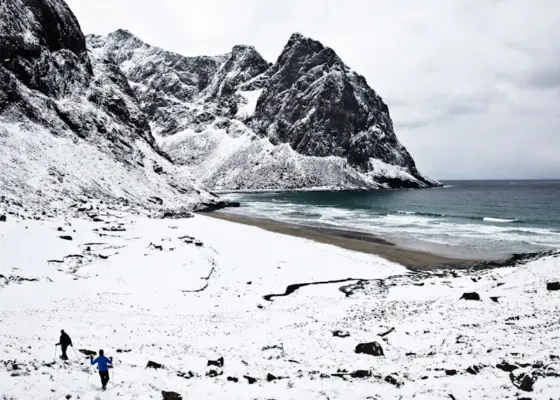
Kvalvika Beach - Lofoten
One-hour hike over the mountain to Kvalvika, a white sand beach with turquoise water and steep cliffs.
The Kvalvika trail starts at the car park by Fv808 and is about 1,9 km each way over the mountain. Plan 2 to 2,5 hours with some time on the beach.
- 3,4 km · ~5 min
-
Sleep
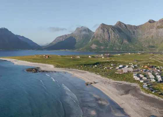
Lofoten Beach Camp
Lofoten Beach Camp is located in the heart of the stunning Lofoten Islands.

Day 6
Reine, Sørvågen and back east
Drive the last stretch of the E10 across Moskenesøya to Reine and Sørvågen, a few minutes from Å where the road ends. Climb Reinebringen if you are up for it, or take the short walk to the Sørvågen waterfalls. On the way back east, stop in Nusfjord, one of the oldest and best kept fishing villages in Norway, and sleep at Hov Gård on Gimsøy with only a sandy beach between you and the open sea.
- 21 km · ~21 min
-
22 Landmark / POI
Akkarvikodden – Lofoten
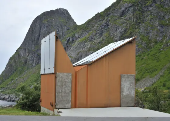
Rest stop on the E10 across Moskenesøya with a sculptural service building shaped like the steep Lofoten peaks around it.
Akkarvikodden is a rest stop on the Lofoten scenic route. The toilets are closed from early October to early May.
-
If you have time
Reinebringen - Lofoten
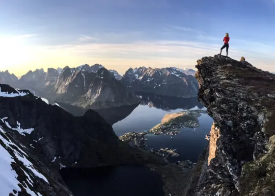
Very steep track with an amazing view into the fjord. The descent becomes slippery in rainy weather.
- 14 km · ~17 min
-
23 Landmark / POI
Sørvågen Waterfalls – Lofoten
Cascades on the Munkebu trail just outside Sørvågen, a short walk from the hikers' car park. A summer walk: steep, wet rock off the main path.
Park at the paid hikers' car park by Sørvågvatnet. It fills up on sunny days, and you can't stay the night there in a camper.
- 47 km · ~52 min
-
24 Landmark / POI
Nusfjord – Lofoten
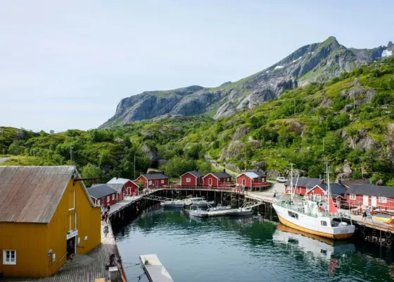
One of Norway’s oldest and best-preserved fishing villages, 6 km off the E10 on Flakstadøya.
Nusfjord is 6,2 km off the E10 on a small side road along the fjord.
- 74 km · ~1 h 17 min
-
Sleep
Hov Gård
Campsite on the outer side of Lofoten, with only a white sandy beach between you and the open sea.
Day 7
Off the islands
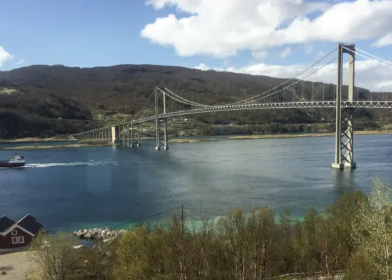
This is the longest day, almost all of it on the E10. You leave Lofoten on Lofast, the road that has linked the islands to the mainland since December 2007, and eat with a view of the Tjeldsund bridge. Harstad, the second town of Troms, is a detour if you want to see Trondenes church, finished around 1440. The night is on a small peninsula in the Gratangen fjord.
- 189 km · ~3 h 10 min
-
26 Restaurant & Cafe
Tjeldsundbrua Kro
Restaurant serving freshly prepared food with a great view towards the Tjeldsund bridge.
-
If you have time
Harstad
Herring town on Hinnøya with the world's northernmost medieval church at Trondenes, the giant Adolf Gun and a pool inside the mountain.
Harstad adds about 50 km and an hour to the day.
Foldvika is down a bumpy dirt road and is often taken. Silsand, 7 km away, is the backup.
- 55 km · ~58 min
-
Sleep
Foldvika Gratangen Troms
Park your camper directly on the fjord on a tiny peninsula. Find a fireplace with a nice view.
Day 8
Målselvfossen and back to Tromsø
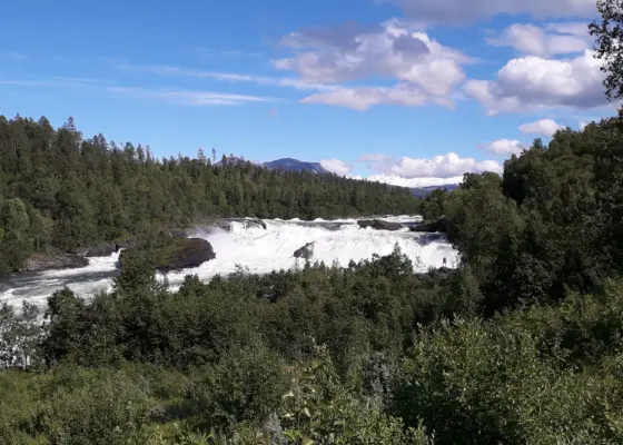
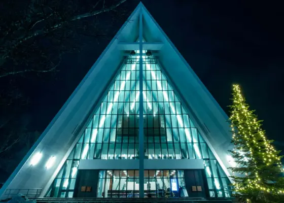
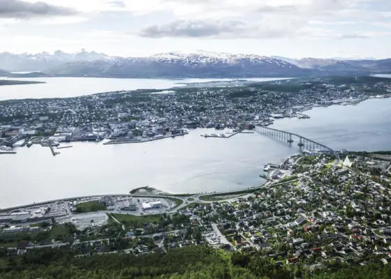
On the way north, stop at Målselvfossen, not one big fall but 600 metres of rapids that radio listeners voted Norway's national waterfall in 2003. Then drive on to Tromsø. You come in past the Arctic Cathedral at the Tromsdalen end of the Tromsø Bridge, and the depot at Kvaløysletta is across the island and over the Sandnessund Bridge.
- 87 km · ~1 h 29 min
-
28 Landmark / POI
Målselvfossen – Målselv
Norway’s “national waterfall”: 600 metres of rapids in three falls in the Målselva, with a salmon ladder from 1910 that lets the salmon swim on upstream.
There has been a salmon viewing room by the ladder, open from mid-June to mid-August. Check with Målselv municipality that it's open before you plan around it.
-
If you have time
Arctic Cathedral – Tromsø
Tromsø’s landmark church of 1965, with its white triangular roof and one of Europe’s largest glass mosaics.
-
If you have time
Fjellheisen Tromsø
The Fjellheisen cable car runs from Tromsdalen up to Storsteinen (421 m) in four minutes, with a view over Tromsø island and the mountains. Or walk up the Sherpa Stairs in summer.
There is no parking at the lower station of Fjellheisen while it is being rebuilt; the free car park is about 5 minutes' walk away.
- 134 km · ~2 h 29 min
-
You can drop the van off at any time of day, with the keys in our key box.
Drive this Roadtrip
Start at Arctic Campers Tromsø with a camper for 8 days.